Horjul, Horjul
Pages with Slovene IPAPopulated places in the Municipality of Horjul

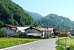
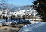
Horjul (pronounced [xɔˈɾjuːl]) is a small town in the Inner Carniola region of Slovenia. It is the administrative center of the Municipality of Horjul. It developed from a clustered village on the north side of the marshy valley of Horjulka Creek. It includes the hamlets of Vovčne and Lipalca. Elevations in the territory of the settlement include Brezovec Hill (471 m), Rog Hill (448 m), and Lupar Hill (Slovene: Luparjev grič) (ca. 420 m) to the north, and Rožman Peak (Slovene: Rožmanski vrh) (452 m), Kremenik Hill (406 m), and Čelc Hill (391 m) to the south.
Excerpt from the Wikipedia article Horjul, Horjul (License: CC BY-SA 3.0, Authors, Images).Horjul, Horjul
Ljubljanska cesta, Upravna Enota Ljubljana
Geographical coordinates (GPS) Address Nearby Places Show on map
Geographical coordinates (GPS)
| Latitude | Longitude |
|---|---|
| N 46.022955555556 ° | E 14.298133333333 ° |
Address
Ljubljanska cesta 57
1354 Upravna Enota Ljubljana
Slovenia
Open on Google Maps


