Municipal Borough of Beddington and Wallington
Districts abolished by the London Government Act 1963History of local government in London (1889–1965)History of the London Borough of CroydonHistory of the London Borough of SuttonMunicipal boroughs of England

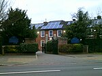
Beddington and Wallington was, from 1915 to 1965, a local government district in north east Surrey, England. It formed part of the London suburbs, lying within the Metropolitan Police District and the London Passenger Transport Area. In 1965 it was abolished on the creation of Greater London.
Excerpt from the Wikipedia article Municipal Borough of Beddington and Wallington (License: CC BY-SA 3.0, Authors, Images).Municipal Borough of Beddington and Wallington
Bandon Rise, London South Beddington (London Borough of Sutton)
Geographical coordinates (GPS) Address Nearby Places Show on map
Geographical coordinates (GPS)
| Latitude | Longitude |
|---|---|
| N 51.361 ° | E -0.138 ° |
Address
Bandon Rise
Bandon Rise
SM6 8PT London, South Beddington (London Borough of Sutton)
England, United Kingdom
Open on Google Maps


