place

Holy Cross High School (Queens)

1955 establishments in New York CityEducational institutions established in 1955Flushing, QueensHoly Cross High School (Flushing) alumniHoly Cross secondary schools
Roman Catholic Diocese of BrooklynRoman Catholic high schools in Queens, New YorkUse mdy dates from November 2013
Holy cross high school

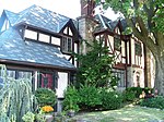
Holy Cross High School is a co-educational Catholic high school located in Flushing, in the New York City borough of Queens. Formerly a boys' school, the school began to admit girls from the 2018–19 academic year. Founded in 1955, Holy Cross High School was chartered by the Board of Regents of the University of the State of New York and accredited by the Middle States Association of Colleges and Schools. Located within the Roman Catholic Diocese of Brooklyn, the school is sponsored by the Brothers of Holy Cross. There is a 98% college placement rate. The School's team is the Holy Cross Knights and the school's athletic archrival is the St. Francis Preparatory School Terriers. Since they are both located on Francis Lewis Boulevard approximately 2.5 miles (4.0 km) apart, when they play each other the game is called the Battle of the Boulevard.

Excerpt from the Wikipedia article Holy Cross High School (Queens) (License: CC BY-SA 3.0, Authors, Images).

Holy Cross High School (Queens)
170th Street, New York Queens County

Geographical coordinates (GPS) Address Nearby Places
placeShow on map

Wikipedia: Holy Cross High School (Queens)Continue reading on Wikipedia

Geographical coordinates (GPS)

Latitude Longitude
N 40.771111111111 ° E -73.795277777778 °
placeShow on map

Address

170th Street 27-49
11358 New York, Queens County
New York, United States
mapOpen on Google Maps

Holy cross high school
Share experience

Nearby Places

Flushing, Queens
Flushing, Queens

Flushing is a neighborhood in the north-central portion of the New York City borough of Queens. The neighborhood is the fourth-largest central business district in New York City. Downtown Flushing is a major commercial and retail area, and the intersection of Main Street and Roosevelt Avenue at its core is the third-busiest in New York City, behind Times Square and Herald Square.Flushing was established as a settlement of New Netherland on October 10, 1645, on the eastern bank of Flushing Creek. It was named Vlissingen, after the Dutch city of Vlissingen. The English took control of New Amsterdam in 1664, and when Queens County was established in 1683, the "Town of Flushing" was one of the original five towns of Queens. In 1898, Flushing was consolidated into the City of New York. Development came in the early 20th century with the construction of bridges and public transportation. An immigrant population, composed mostly of Chinese and Koreans, settled in Flushing in the late 20th century. Flushing contains numerous residential subsections, and its diversity is reflected by the numerous ethnic groups that reside there. Flushing is served by several stations on the Long Island Rail Road's Port Washington Branch, as well as the New York City Subway's IRT Flushing Line (7 and <7>​ trains), which has its terminus at Main Street. Flushing is located in Queens Community District 7, and its ZIP Codes are 11354, 11355, and 11358. It is patrolled by the New York City Police Department's 109th Precinct.

Sylvania Electric Products explosion

On the morning of July 2, 1956, three explosions involving scrap thorium occurred at the Sylvania Electric Products' Metallurgical Laboratory in Bayside, (now Bay Terrace) Queens, New York. Nine people were injured, some severely. One 28 year old employee, Oliver Blaber died on August 6, 1956. Workers described three fireballs.Sylvania was experimenting with large-scale production of thorium metal from thorium dioxide. Part of the process of shutting down this experiment was the reprocessing and burning of thorium metal powder sludges that went unprocessed during the experiment. It was during the incineration of this material that the explosion occurred. At the time the metallurgical properties of thorium were not well understood. The plant's medical director stated to the press at the time that the employee who died as a result, Oliver Blaber, had succumbed to "complications caused by third-degree burns". Blaber's son would later cite the death certificate, which listed "thorium poisoning". Victims of the explosions were treated at Flushing Hospital, where both Blaber's mother and wife worked. Blaber died a month after the incident, on August 6, 1956.Three hundred people – 225 employees, 50 firefighters, and 25 police officers – were tested for radiation. The role of radiation was downplayed, especially to assuage fears that a nuclear explosion had occurred. The debris from the explosion was ultimately disposed of in the ocean.

Travis Triangle
Travis Triangle

Travis Triangle is a narrow green space in the Murray Hill/Flushing neighborhoods of Queens, New York City. It is formed by the separation of Murray Street and Murray Lane, both of which were named after the Murray family, which owned land on the site of these streets from the late colonial period through the early 19th century. In 1932, New York City's Board of Aldermen passed a resolution to name this site Travis Triangle in honor of local American Civil War veteran Ira Underhill Travis (1839-1921), who fought under the name Ira Wilson, in the 11th New York Volunteer Infantry Regiment also known as Colonel Elmer E. Ellsworth’s Zouaves.In the incident at Marshall House Inn during the Union Army's occupation of Alexandria, Virginia, his commander was killed after removing a Confederate flag. Travis kept a piece of the flag as a souvenir for his family In July 1861, Travis received a bullet wound in his shoulder in the First Battle of Manassas. The bullet remained lodged in his shoulder for the rest of his life. Travis was buried at Flushing Cemetery.With the arrival of the subway to Flushing in 1928, the neighborhood expanded to the north and east and parks were built to accommodate the new residents. Parcels that were too small to develop, such as this site, were designated as green spaces maintained by the city's Parks Department. The park contains plots for 24 trees and a bench on its northern side. Continuing north, Murray Lane gradually narrows, taking on the appearance of a countryside lane, having changed little as the surrounding neighborhood transformed over a century from farmland towards residential.