Topcliffe, North Yorkshire
Civil parishes in North YorkshireOpenDomesdayUse British English from July 2016Villages in North Yorkshire

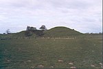
Topcliffe is a village and civil parish in the Hambleton district of North Yorkshire, England. The village is situated on the River Swale, on the A167 road and close to the A168. It is about 5 miles (8 km) south-west of Thirsk and 11 miles (18 km) south of the county town of Northallerton. It has a population of 1,489. An army barracks, with a Royal Air Force airfield enclosed within, is located to the north of the village.
Excerpt from the Wikipedia article Topcliffe, North Yorkshire (License: CC BY-SA 3.0, Authors, Images).Topcliffe, North Yorkshire
Long Street,
Geographical coordinates (GPS) Address Nearby Places Show on map
Geographical coordinates (GPS)
| Latitude | Longitude |
|---|---|
| N 54.178 ° | E -1.387 ° |
Address
Long Street
Long Street
YO7 3RP , Topcliffe
England, United Kingdom
Open on Google Maps


