place

Topcliffe Castle

Castles in North YorkshireEngland castle stubsUse British English from September 2020
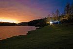
Topcliffe Motte, Maiden Bower. geograph.org.uk 316741

Topcliffe Castle (also known as Maiden's Bower) is an abandoned castle located near the village of Topcliffe, North Yorkshire, England.The castle was built at the junction of the River Swale and Cod Beck. A motte and bailey castle was constructed around 1071. Archbishop Geoffrey of York re-fortified the castle in 1173 during the revolt of 1173-74, with William de Stuteville appointed as governor. The Percy family held Topcliffe. Edward III of England spent a few hours resting at the castle in August 1333. The castle appears to have been abandoned during the 14th century. In 1489, on the site of the castle, Henry Percy, 4th Earl of Northumberland was slain by an angry mob in regard to higher taxation.

Excerpt from the Wikipedia article Topcliffe Castle (License: CC BY-SA 3.0, Authors, Images).

Topcliffe Castle
Whaites Lane,

Geographical coordinates (GPS) Address Nearby Places
placeShow on map

Wikipedia: Topcliffe CastleContinue reading on Wikipedia

Geographical coordinates (GPS)

Latitude Longitude
N 54.1695 ° E -1.3732 °
placeShow on map

Address

Maiden Bower (Motte and Bailey)

Whaites Lane
YO7 3QP
England, United Kingdom
mapOpen on Google Maps

Topcliffe Motte, Maiden Bower. geograph.org.uk 316741
Share experience

Nearby Places

North Yorkshire
North Yorkshire

North Yorkshire is a ceremonial county in the Yorkshire and the Humber and North East regions of England. It borders County Durham to the north, the North Sea to the east, the East Riding of Yorkshire to the south-east, South Yorkshire to the south, West Yorkshire to the south-west, and Cumbria and Lancashire to the west. Northallerton is the county town. The county is the largest in England by land area, at 9,020 km2 (3,480 sq mi), and has a population of 1,158,816. The largest settlements are Middlesbrough (174,700) in the north-east and the city of York (152,841) in the south. Middlesbrough is part of the Teesside built-up area, which extends into County Durham and has a total population of 376,663. The remainder of the county is rural, and the largest towns are Harrogate (73,576) and Scarborough (61,749). For local government purposes the county comprises four unitary authority areas — York, Middlesbrough, Redcar and Cleveland, and North Yorkshire — and part of a fifth, Stockton-on-Tees. The centre of the county contains a wide plain, called the Vale of Mowbray in the north and Vale of York in the south. The North York Moors lie to the east, and south of them the Vale of Pickering is separated from the main plain by the Howardian Hills. The west of the county contains the Yorkshire Dales, an extensive upland area which contains the source of the River Ouse/Ure and many of its tributaries, which together drain most of the county. The Dales also contain the county's highest point, Whernside, at 2,415 feet (736 m).