place

Prorer Wiek

Bays of Mecklenburg-Western PomeraniaBays of the Baltic SeaGeography of RügenVorpommern-Rügen geography stubs
Prorer Wiek
Prorer Wiek

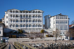
The Prorer Wiek is a bay on Germany's Baltic Sea coast off the bar of Schmale Heide that runs between the peninsula of Jasmund and the Granitz, the region southeast of Binz on the island of Rügen. The resort of Prora lies on the shore of the bay with its former "Strength Through Joy" spa and the seaside resort of Binz. In the northern part of the bay is the Sassnitz Ferry Port near the Sassnitz village of Mukran.

Excerpt from the Wikipedia article Prorer Wiek (License: CC BY-SA 3.0, Authors, Images).

Prorer Wiek
Küstengewässer einschließlich Anteil am Festlandsockel

Geographical coordinates (GPS) Address Nearby Places
placeShow on map

Wikipedia: Prorer WiekContinue reading on Wikipedia

Geographical coordinates (GPS)

Latitude Longitude
N 54.45 ° E 13.633333333333 °
placeShow on map

Address

Küstengewässer einschließlich Anteil am Festlandsockel


18569 Küstengewässer einschließlich Anteil am Festlandsockel
Mecklenburg-Vorpommern, Germany
mapOpen on Google Maps

Prorer Wiek
Prorer Wiek
Share experience

Nearby Places

Schmachter See
Schmachter See

Schmachter See is a lake near Binz on the German Baltic Sea island of Rügen. It lies within the county of Vorpommern-Rügen in the state of Mecklenburg-Vorpommern. It has an elevation of 1.1 metres above sea level and its surface area is 1.18 km2. It is part of the Schmachter See and Fangerien Nature Reserve. The lake has its origins in the Ice Age. At the end of the glacial period there was an ice front here. Today the lake has an area of about 118 hectares. Before about 14,000 years ago the lake, which was then still part of the Baltic Sea, had a depth of up to 15 metres. About 5,000 years ago the waterbody was cut off from the Baltic by the bar of the Schmale Heide. Its only link to the Baltic is the drainage ditch of the Ahlbeck stream. As a result of natural silting-up processes it is today a shallow lake. In the centre it has a depth of only one to two metres. In addition the lake has lost a lot of its former area. Originally it purportedly reached as far south as Nistelitz. The name of the lake comes from the settlement of Schmacht to the southwest, but which no longer lies on the lake shore. The Ahlbeck, which drains the lake into the Baltic Sea, was canalised in the 1950s. The mouth of the pipe or ditch is located on the beach of Binzer Strand and is marked by an information sign. A variety of animal and plant species live on the lake and, including 40 species on the IUCN Red List of Threatened Species. For example, the bittern reed warbler greylag goose, goosander, smew white-tailed eagle and osprey occur here. The shores of the lake are mainly covered in beech woods. At the foot of the slopes are seepage springs. Close to the lake are alder carrs and marshes. The shore itself is mainly fringed by reeds and quaking bog vegetation. At the northern end the lake is the village of Binz. Here, there is a promenade and the "Park of Senses" (Park der Sinne).