place

Prora

Abandoned military projects of GermanyBaltic Sea beaches of GermanyBinzBuildings and structures in Mecklenburg-Western PomeraniaBundeswehr
Defunct hotels in GermanyHotel buildings completed in 1939Military of East GermanyNazi architectureRügenVague or ambiguous time from November 2014
20 07 06 Prora RalfR DJI 0120

The Colossus of Prora, commonly known as simply "Prora", is a building complex in the municipality of Binz on the island of Rügen, Germany. It was built by Nazi Germany between 1936 and 1939 as part of the Strength Through Joy (Kraft durch Freude or KdF) project. It consisted of eight identical buildings and was 4.5 km (2.8 mi) in length parallel to the beach, with the surviving structures stretching 3.0 km (1.9 mi). Although the buildings were planned as a holiday resort, construction was not completed and they were not used for this purpose. Prora, as it was known, was however used largely by the Nazi Party for propaganda, with the supposed strength and power displayed in the construction effort of the complex likened by the party to that of themselves. After World War II, the complex found various military uses, first by the Soviet Army, then by the East German Volksarmee, and then by the German Bundeswehr. Today it houses a large youth hostel, a hotel and holiday apartments. The complex has a formal heritage listing as a particularly striking example of Nazi architecture.

Excerpt from the Wikipedia article Prora (License: CC BY-SA 3.0, Authors, Images).

Geographical coordinates (GPS)

Latitude Longitude
N 54.439166666667 ° E 13.575555555556 °
placeShow on map

Address

59
18609
Mecklenburg-Vorpommern, Germany
mapOpen on Google Maps

20 07 06 Prora RalfR DJI 0120
Share experience

Nearby Places

Southeast Rügen Biosphere Reserve

The Southeast Rügen Biosphere Reserve (German: Biosphärenreservat Südost-Rügen) is a biosphere reserve in the German state of Mecklenburg-Vorpommern, which covers the southeastern part of the island of Rügen (including Granitz and Mönchgut), the lagoon of Rügischer Bodden between Putbus and Thiessow, the outer coast between Thiessow and Binz and the island of Vilm. In the biosphere reserve all the classic landscape and coastal features of the Mecklenburg-Vorpommern littoral are found within one small area. The land is deeply indented here by the sea. One the one hand, peninsulas and coastal headlands are linked by narrow strips of land, on the other side they are separated by lagoons known as boddens and open bays called Wieken locally. There are fine-sanded beaches and rugged cliffed coastlines, at the foot of which are impressive rocky beaches. Broad belts of reed girdle the shores. Beech woods or poor grasslands are found on the sites of terminal moraines and meadows and pastures in the depressions formed after the Ice Ages. Cultural features include megalithic tombs of the New Stone Age, Bronze Age tumuli, medieval churches and village layouts, and the resort architecture of the Modern Era. It was made a biosphere reserve in 1990 as part of the GDR's national park programme. Area: 235 km2 Its variety of species includes its: great importance as a rest and breeding area for migratory birds, mainly various species of goose (greylag, bean and greater white-fronted geese) bee species: e. g. furry, apex-furrowed and cone bees; cuckoo and social wasps. colonies of seagrass, red and green algae in the nearshore areas of the Bay of Greifswald that form spawning grounds for Baltic Sea herring.The biosphere reserve has several core zones or total reserves. These include the Schwarzer See in the Granitz as well as the islands of Vilm and parts of the Mönchgut and Zicker peninsulas.

Schmachter See
Schmachter See

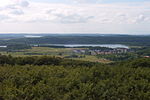
Schmachter See is a lake near Binz on the German Baltic Sea island of Rügen. It lies within the county of Vorpommern-Rügen in the state of Mecklenburg-Vorpommern. It has an elevation of 1.1 metres above sea level and its surface area is 1.18 km2. It is part of the Schmachter See and Fangerien Nature Reserve. The lake has its origins in the Ice Age. At the end of the glacial period there was an ice front here. Today the lake has an area of about 118 hectares. Before about 14,000 years ago the lake, which was then still part of the Baltic Sea, had a depth of up to 15 metres. About 5,000 years ago the waterbody was cut off from the Baltic by the bar of the Schmale Heide. Its only link to the Baltic is the drainage ditch of the Ahlbeck stream. As a result of natural silting-up processes it is today a shallow lake. In the centre it has a depth of only one to two metres. In addition the lake has lost a lot of its former area. Originally it purportedly reached as far south as Nistelitz. The name of the lake comes from the settlement of Schmacht to the southwest, but which no longer lies on the lake shore. The Ahlbeck, which drains the lake into the Baltic Sea, was canalised in the 1950s. The mouth of the pipe or ditch is located on the beach of Binzer Strand and is marked by an information sign. A variety of animal and plant species live on the lake and, including 40 species on the IUCN Red List of Threatened Species. For example, the bittern reed warbler greylag goose, goosander, smew white-tailed eagle and osprey occur here. The shores of the lake are mainly covered in beech woods. At the foot of the slopes are seepage springs. Close to the lake are alder carrs and marshes. The shore itself is mainly fringed by reeds and quaking bog vegetation. At the northern end the lake is the village of Binz. Here, there is a promenade and the "Park of Senses" (Park der Sinne).