place

Highland Lakes State Park

1964 establishments in New York (state)Hudson Valley, New York geography stubsPalisades Interstate Park systemParks in Orange County, New YorkProtected areas established in 1964
State parks of New York (state)Use mdy dates from August 2023
Highland Lakes State Park

Highland Lakes State Park is a 3,115-acre (12.61 km2) undeveloped state park in the towns of Wallkill and Crawford in Orange County, New York, United States. The park is located northeast of the city of Middletown, west of Route 211. It is the largest undeveloped park managed by the Palisades Interstate Park Commission.

Excerpt from the Wikipedia article Highland Lakes State Park (License: CC BY-SA 3.0, Authors, Images).

Highland Lakes State Park
Tamms Road, Town of Wallkill

Geographical coordinates (GPS) Address Nearby Places
placeShow on map

Wikipedia: Highland Lakes State ParkContinue reading on Wikipedia

Geographical coordinates (GPS)

Latitude Longitude
N 41.5096 ° E -74.3236 °
placeShow on map

Address

Tamms Road 274
10941 Town of Wallkill
New York, United States
mapOpen on Google Maps

Highland Lakes State Park
Share experience

Nearby Places

William Bull III House

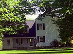
The William Bull III House is on a hill overlooking the Wallkill River in the Town of Wallkill in Orange County, New York. It was built by Bull, who was the grandson of early settlers Sarah Wells and William Bull, sometime in the 1780s. William Bull III was a lieutenant in the American Revolution under Col. Oliver Spencer and was at Valley Forge. He received a brevet commission for merit from Lord Sterling after the Battle of Monmouth. Bull and his son William IV, on returning home in 1781 from serving with Gen. George Washington's campaign against the British, had been impressed with the buildings of Baltimore and other Atlantic seaports visited during his military service. The name "Brick Castle" is shared among a few early brick homes constructed in the area around the same time. Bull decided upon arriving home to build a brick homestead. Bull's grandfather built many stone houses through the area including Knox Headquarters in Vails Gate in 1756. It is possible that the elder Bull also contributed to construction of is Gen. Washington's headquarters at Newburgh, NY. The Bull Stone House, which the elder Bull began to build in 1722 and took 13 years to complete, still stands today and is owned and occupied by his descendants. Most of the materials for Bull's Brick Castle were taken from the land around the farm, including the clay. Ostensibly the brick kilns were built on site, but remains have to yet to be recovered. A New York State Historical Register sign on the site states that the building was constructed "for a price of $800.00." This statement has never been verified, nor what construction costs it actually covered. The original homestead was a timber cabin with stone foundations. No portions of the original structure are visible. William Bull's descendants were dairy farmers, and the property was maintained as a dairy farm until 1964. Only one other historic structure, an 1830s carriage house, remains on the property. The other outbuildings were destroyed in by fire in 1964. Six generations of the family have lived there, and it remains a private residence for Bull's descendants today.It was added to the National Register of Historic Places on September 25, 1986.

Bodine's Bridge
Bodine's Bridge

Bodine's Bridge carries New York State Route 211 across the Wallkill River, a mile (1.6 km) south (west by the highway's signed direction) of the village of Montgomery, New York, United States, near Orange County Airport. At 340 feet (103 m) in length, the steel through truss is the longest bridge along Route 211. The current bridge was built in 2015. Its predecessor dated to 1933, with a reconstruction in 1970. All the bridges at the location have been named after nearby, still-standing Bodine's Tavern, a popular rest stop on the early 19th century Minisink to Montgomery Turnpike, which later became Route 211. The house, now listed on the National Register of Historic Places, was built near a popular ford along the river, which the bridges were built over. Due to the bridge's location in the river's flood plain, it is often closed after heavy rains when its approaches, particularly to the south, are overrun by rising waters. This happened most recently during the April 2007 Nor'easter.In summer 2015 the state Department of Transportation began replacing the bridge. Route 211 was closed through the bridge at the beginning of June; traffic was detoured via Goshen Turnpike (County Route 101) in the Town of Wallkill through the hamlet of Scotchtown to State Route 17K via Scotchtown–Collabar Road (County Route 47). The new bridge, completed and opened in September of that year, has three continuous spans, two 12-foot (3.7 m) travel lanes and 6-foot (1.8 m) shoulders. The project was estimated to have cost $8.1 million; it is being paid for by a Federal Emergency Management Agency grant program to replace old scour-prone bridges in areas subject to frequent flooding.