place

Lazaretto Point War Memorial

1922 sculptures1923 establishments in ScotlandBritish military memorials and cemeteriesBuildings and structures in Argyll and ButeCenotaphs in the United Kingdom
Monuments and memorials in ScotlandOutdoor sculptures in ScotlandScottish building and structure stubsStone sculptures in ScotlandWorld War II memorials in ScotlandWorld War I memorials in Scotland
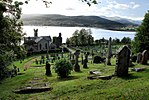
Lazaretto Point war memorial (geograph 6203131)

Erected in 1922, the Lazaretto Point War Memorial (known colloquially as the Lazaretto Memorial) is located in the Scottish village of Ardnadam in Argyll and Bute. It stands, at the apex of sharp bend in the A815, around the midpoint of the southern shores of the Holy Loch. It was designed by Boston, Menzies & Morton, of Greenock, and unveiled on 14 May 1922. It commemorates the local soldiers who died during service in World War I and World War II.Mrs John Brown, of nearby Sandbank, performed the unveiling. Five of her sons served in the conflicts, one of whom was killed in action. Reverend A. MacDonald M.A., also of Sandbank, officiated at the ceremony.

Excerpt from the Wikipedia article Lazaretto Point War Memorial (License: CC BY-SA 3.0, Authors, Images).

Lazaretto Point War Memorial
Shore Road,

Geographical coordinates (GPS) Address Nearby Places
placeShow on map

Wikipedia: Lazaretto Point War MemorialContinue reading on Wikipedia

Geographical coordinates (GPS)

Latitude Longitude
N 55.9818274 ° E -4.93102446 °
placeShow on map

Address

Sandbank War Memorial

Shore Road
PA23 8QD
Scotland, United Kingdom
mapOpen on Google Maps

Lazaretto Point war memorial (geograph 6203131)
Share experience

Nearby Places

Milton Burn
Milton Burn

Milton Burn is a watercourse in Argyll and Bute, Scotland. It is sourced from Loch Loskin in Kirn and largely runs parallel to the A885 road as it leads south to Dunoon. It is around 1.02 miles (1.64 km) long.It is crossed by several roads during its southward flow: Sandbank Road, Hamilton Street, Argyll Street, Pilot Street, Milton Road and George Street. It disappears beneath Alexandra Parade immediately before its discharge into the Firth of Clyde between Queen Street and Milton Road in Dunoon's East Bay. Milton Burn forms a natural little harbour in the lovely shore of Dunoon, then almost tenantless, and without visible habitations of man — but now studded with so many dwellings of kindness and comfort. East Bay was originally named Milton Bay by James MacArthur Moir, a miller who became laird of Milton. In 1884, the burn is mentioned as being crossed by Mill Street, which no longer exists. Milton Mill was situated on the burn between Milton Road and George Street. Milton was the name of the estate on which Dunoon was partly built.In 1885, The Scottish Law Reporter also wrote: Leading out of Dunoon there is a street now only partly formed, intersected by a burn called the Milton Burn, over which there was an old wooden bridge. This was considered dangerous, and was removed by the commissioners, and replaced by a stone bridge. In July 1989, the body of 25-year-old Gourock resident Joyce Hepburn was found in the burn near George Street. Hundreds of sailors stationed at the nearby Holy Loch were questioned by police, as many of them came ashore on leave every second Thursday after receiving their wages. Witnesses recalled seeing a male and a female arguing in George Street, above the point where Hepburn's body was later found. The body of Ivan Miller, Hepburn's fiancé and a United States Navy dental technician, was found a week later in the hills behind Dunoon. He had committed suicide.Eight months of flood prevention work began around the burn in June 2011. A culvert was connected to the burn via a weir, allowing water to be removed from the burn during and after heavy rainfall.A whisky distillery is believed to have stood beside the burn near where it is crossed by Argyll Street.The burn flows through Milton Burn Gardens, which was created on the eastern side of Argyll Street between Queen Street and John Street.