Caer Llan
Country houses in MonmouthshireField studies centres in the United KingdomSites of Special Scientific Interest in Monmouthshire

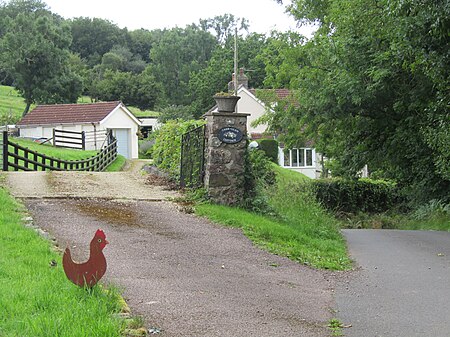
Caer Llan is a field studies centre, conference centre and former country house located at Lydart within the community of Mitchel Troy, Monmouthshire, south east Wales, about 3 miles (4.8 km) south-west of Monmouth. It is close to the top of a scarp slope with extensive views westwards over the valley of the River Trothy, and is accessed from the B4293 road.
Excerpt from the Wikipedia article Caer Llan (License: CC BY-SA 3.0, Authors, Images).Caer Llan
Craig-y-Dorth,
Geographical coordinates (GPS) Address Nearby Places Show on map
Geographical coordinates (GPS)
| Latitude | Longitude |
|---|---|
| N 51.7717 ° | E -2.7391 ° |
Address
Craig-y-Dorth
Craig-y-Dorth
NP25 4JS , Mitchel Troy
Wales, United Kingdom
Open on Google Maps


