Dreiborn Plateau
Geography of North Rhine-WestphaliaRegions of the Eifel

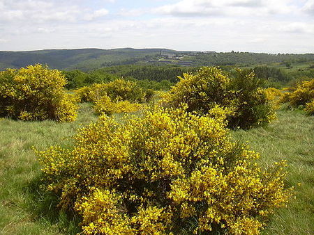
The Dreiborn Plateau (German: Dreiborner Hochfläche) is an area of woods and open terrain, some 33 square kilometres in area, in the Eifel National Park. It corresponds to the area of the Vogelsang Military Training Area which was handed back on 31 December 2005 and had been out-of-bounds to the public since 1 September 1946. Since 2006 parts of the area have been opened up to the public who may use certain routes through it.
Excerpt from the Wikipedia article Dreiborn Plateau (License: CC BY-SA 3.0, Authors, Images).Dreiborn Plateau
B 266,
Geographical coordinates (GPS) Address Nearby Places Show on map
Geographical coordinates (GPS)
| Latitude | Longitude |
|---|---|
| N 50.563333333333 ° | E 6.4163888888889 ° |
Address
B 266
53937
North Rhine-Westphalia, Germany
Open on Google Maps


