Vogelsang Training Area

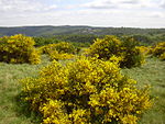
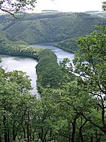
The Vogelsang Training Area (German: Truppenübungsplatz Vogelsang) lay in the German North Eifel hills between the villages of Simmerath, Heimbach and Schleiden in the state of North Rhine-Westphalia. It was established in 1946 and handed back at the end of 2005, and consisted of the grounds of the former Nazi leadership training centre in the fort of Vogelsang (Ordensburg Vogelsang) on the Erpenscheid hill plus additional terrain including the so-called Dreiborn Plateau. In the north and east it was bounded by the Urft Reservoir. The training area had an area of around 45 km2 and since 1 January 2006 has been fully incorporated into the Eifel National Park.Until 1950 the training area was run by the British Armed Forces and thereafter until 31 December 2005 by the Belgian Army.
Excerpt from the Wikipedia article Vogelsang Training Area (License: CC BY-SA 3.0, Authors, Images).Vogelsang Training Area
Ähßisch Jajß,
Geographical coordinates (GPS) Address Nearby Places Show on map
Geographical coordinates (GPS)
| Latitude | Longitude |
|---|---|
| N 50.579592 ° | E 6.423858 ° |
Address
Wollseifen
Ähßisch Jajß
53937
North Rhine-Westphalia, Germany
Open on Google Maps


