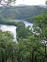
Verbrannter Berg
Mountains and hills of the Eifel
The Verbrannter Berg ("Burnt Mountain") near Wolfgarten in the county of Euskirchen in the German state of North Rhine-Westphalia is a hill, 516.2 m above sea level (NHN), in the Kermeter, a ridge in the Eifel mountains, in the region of Rur Eifel; at the same time Verbrannter Berg is the name of a parcel of land.
Excerpt from the Wikipedia article Verbrannter Berg (License: CC BY-SA 3.0, Authors).Verbrannter Berg
Kermeterstraße,
Geographical coordinates (GPS) Address Nearby Places Show on map
Geographical coordinates (GPS)
| Latitude | Longitude |
|---|---|
| N 50.61275 ° | E 6.4450555555556 ° |
Address
Kermeterstraße
53937
North Rhine-Westphalia, Germany
Open on Google Maps


