Angle Park, South Australia
Suburbs of AdelaideUse Australian English from August 2019
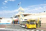
Angle Park is a north-western suburb of Adelaide 10 km from the CBD, in the state of South Australia, Australia and falls under the City of Port Adelaide Enfield. It is adjacent to Wingfield, Mansfield Park, Ferryden Park, and Regency Park. The post code for Angle Park is 5010. It is bounded to the north by Grand Junction Road, west by Trafford Street, and to the east by Days Road and the North-South Motorway.
Excerpt from the Wikipedia article Angle Park, South Australia (License: CC BY-SA 3.0, Authors).Angle Park, South Australia
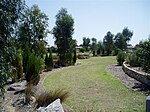
Hilton Court, Adelaide Angle Park
Geographical coordinates (GPS) Address Nearby Places Show on map
Geographical coordinates (GPS)
| Latitude | Longitude |
|---|---|
| N -34.86 ° | E 138.56 ° |
Address
Hilton Court
Hilton Court
5010 Adelaide, Angle Park
South Australia, Australia
Open on Google Maps


