place

Battle of Kiev (1943)

1940s in Kyiv1943 in Ukraine1943 in the Soviet UnionBattles and operations of World War II involving CzechoslovakiaBattles and operations of the Soviet–German War
Battles involving the Soviet UnionBattles of World War II involving GermanyConflicts in 1943Czechoslovakia–Soviet Union relationsDecember 1943 eventsKiev in World War IINovember 1943 events
Kiev Kreschatik after liberation November 1943

The Second Battle of Kiev was a part of a much wider Soviet offensive in Ukraine known as the Battle of the Dnieper involving three strategic operations by the Soviet Red Army and one operational counterattack by the Wehrmacht, which took place between 3 November and 22 December 1943. Following the Battle of Kursk, the Red Army launched the Belgorod-Kharkov Offensive Operation, pushing Erich von Manstein's Army Group South back towards the Dnieper River. Stavka, the Soviet high command, ordered the Central Front and the Voronezh Front to force crossings of the Dnieper. When this was unsuccessful in October, the effort was handed over to the 1st Ukrainian Front, with some support from the 2nd Ukrainian Front. The 1st Ukrainian Front, commanded by Nikolai Vatutin, was able to secure bridgeheads north and south of Kiev.

Excerpt from the Wikipedia article Battle of Kiev (1943) (License: CC BY-SA 3.0, Authors, Images).

Battle of Kiev (1943)
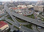
Stratehichne Road, Kyiv Demiivka

Geographical coordinates (GPS) Address Nearby Places
placeShow on map

Wikipedia: Battle of Kiev (1943)Continue reading on Wikipedia

Geographical coordinates (GPS)

Latitude Longitude
N 50.4 ° E 30.54 °
placeShow on map

Address

Stratehichne Road 48/52
03028 Kyiv, Demiivka
Ukraine
mapOpen on Google Maps

Kiev Kreschatik after liberation November 1943
Share experience

Nearby Places

Zvirynetska (Kyiv Metro)

Zvirynetska (Ukrainian: Звіринецька) is a station of Kyiv Metro's Syretsko-Pecherska Line. It is situated between Pecherska and Vydubychi stations. This station was opened on 30 December 1991. Until May 2023 the station was named Druzhby Narodiv or Friendship of Peoples (Ukrainian: Дружби Народів, , named after the former name of Mikhnovsky Boulevard, which is located above the station) Druzhby Narodiv station was designed by architects Alyoshkin and Krushynskiy. It is a deep-level station. The station is connected by escalators with a passenger tunnel situated under Druzhby Narodiv boulevard. The station station operates from 05:43 to 00:12. On Friday 13 January 2023 the Kyiv City Council announced Druzhby Narodiv metro station would be renamed. In a poll organised by them Kyiv residents cast more than 100,000 votes for the renaming of seven city objects, including this station and Ploshcha Lva Tolstoho. In a May 2022 online poll (with 170,000 respondents) voters chose to rename the station Botanical (Ukrainian: Ботанічна) — after the nearby Hryshko National Botanical Garden — in a poll taken during the 2022 Russian invasion of Ukraine; other choices included European and Red Viburnum. The Druzhby Narodiv boulevard itself was renamed to Mykola Mikhnovsky boulevard on 8 December 2022. In the January 2023 poll the majority of votes went to the name Zvirynets (Ukrainian: Звіринець), a historical neighbourhood inside Pecherskyi District where the metro station is situated in. On 18 May 2023 the Kyiv City Council renamed the station to Zvirynetska.

Demiivka
Demiivka

Demiivka (Ukrainian: Деміївка) is a neighborhood located in the Holosiiv Raion (district) of Kyiv, the capital of Ukraine. It is located towards the southern part of the city, in between the city's neighborhoods Chorna Hora, Shyrma, and Holosiiv National Park. Through the neighborhood flows Lybid River and the unofficial name of the neighborhood Nyzhnia Lybid (Lower Lybid). At its eastern edge is located a ridgeline of Kyiv Hills consisting of Lysa Hora, Chorna Hora, and Bahrynova Hora, past which is located Dnipro. Until the 19th century the area was outside of the Kyiv city and was known as Lybidska zemlya (land of Lybid) which had couple of small villages (sloboda) Verkhnyolybidske and Nyzhnyolybidske. The current name the place assumed sometime in the second half of the 19th century as Demiivka of Khotiv volost. In 1909 the Kyiv entrepreneur David Margolin opened in Demiivka a private city tramway company. In 1918 it was included into Kyiv and in 1920s through 1960s carried the name of Stalinka. Under such name, the neighborhood is mentioned in the work of Ukrainian writer Oles Ulianenko, "Stalinka", which received the junior Shevchenko National Prize (existed in 1997–1999). Most of its older building were demolished already in 1970s.The Kyiv Central Bus Station and Vernadsky National Library of Ukraine are located in the neighborhood. Demiivka is served by a Holosiivska and Demiivska metro stations of the Kyiv Metro's Obolonsko–Teremkivska line. The Kyiv Metro in the area was opened in 2010. Beside Kyiv underground rail transport, there is also a regular train station Kyiv-Demiivskyi. Through the neighborhood passes the European route E95. The Demiivska Square is an important intersection through which passes the E95 route and some major streets that lead to the Pivdennyi Bridge (Southern bridge, part of the European route E40). Across from the National Library is located a building of the Holosiivskyi District State Administration. The neighbor is also home to number of older Kyiv industries among which are Kyiv Brewing Factory #1 (Soviet name for former Carl Schultz Brewery), Kyiv Roshen Factory (former Demiivka Sugar Factory), Factory "Kyivhuma" (Kyiv Rubber), Kyiv Artillery Shells Factory, and others.