A20 road (England)
All pages needing cleanupGeographic coordinate listsInfobox road instances in EnglandLists of coordinatesRoads in Kent ... and 6 more
Roads in LondonStreets in the London Borough of BromleyStreets in the London Borough of LewishamTransport in the Borough of AshfordTransport in the London Borough of BexleyUse British English from February 2013

The A20 is a major road in south-east England, carrying traffic from London to Dover in Kent. Parts of the route date back to turnpikes established in the early part of the 18th century. The line of the road throughout Kent runs closely in parallel with the M20 motorway.
Excerpt from the Wikipedia article A20 road (England) (License: CC BY-SA 3.0, Authors, Images).A20 road (England)
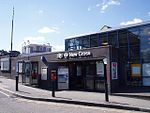
Shardeloes Road, London New Cross (London Borough of Lewisham)
Geographical coordinates (GPS) Address Nearby Places Show on map
Geographical coordinates (GPS)
| Latitude | Longitude |
|---|---|
| N 51.473 ° | E -0.033 ° |
Address
Surrey House & Surrey Annexe
Shardeloes Road
SE14 6RX London, New Cross (London Borough of Lewisham)
England, United Kingdom
Open on Google Maps


