Mapparium
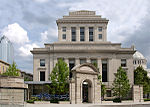
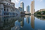
The Mapparium is a three-story-tall globe made of stained glass that is viewed from a 30-foot-long (9.1 m) bridge through its interior. As of August 2021, it is part of the “How Do You See the World?” exhibit of the Christian Science Publishing Society in Boston, Massachusetts. Built in 1935 and based upon Rand McNally political maps published the previous year, the Mapparium shows the political world as it was at that time, including such long-disused labels as Italian East Africa and Siam, as well as more recently defunct political entities such as the Soviet Union. In 1939, 1958, and 1966 the Church considered updating the map, but rejected it on the basis of cost and the special interest it holds as a historical artifact.
Excerpt from the Wikipedia article Mapparium (License: CC BY-SA 3.0, Authors).Mapparium
Clearway Street, Boston Fenway / Kenmore
Geographical coordinates (GPS) Address Nearby Places Show on map
Geographical coordinates (GPS)
| Latitude | Longitude |
|---|---|
| N 42.345208333333 ° | E -71.086361111111 ° |
Address
Christian Science Publishing Society
Clearway Street
02199 Boston, Fenway / Kenmore
Massachusetts, United States
Open on Google Maps


