place

Joint Task Force North

Joint task forces of the United States Armed ForcesMilitary units and formations established in 2004Use American English from December 2013
Joint Task Force North

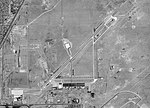
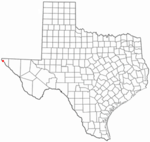
Joint Task Force North (JTF North), formerly Joint Task Force Six (JTF-6), is a multi-service operation by the United States Department of Defense for counterdrug and anti-terrorist operations. JTF-North is headquartered at Biggs Army Airfield, Fort Bliss, Texas. United States Northern Command is the controlling Unified Combatant Command. On 2 July 2019, acting Commander, COL Paul Garcia, relinquished command to Brigadier General Reginald G. A. Neal. On 06 November 2020, Major General Neal transferred command to Major General Randall V. Simmons, Jr., who is the former commander as of December 14, 2022. Major General Matthew D. Smith assumed command on December 14, 2022, and is the 11th Commander of JTF-N.

Excerpt from the Wikipedia article Joint Task Force North (License: CC BY-SA 3.0, Authors, Images).

Joint Task Force North
Old Ironsides Avenue,

Geographical coordinates (GPS) Address Nearby Places
placeShow on map

Wikipedia: Joint Task Force NorthContinue reading on Wikipedia

Geographical coordinates (GPS)

Latitude Longitude
N 31.841388888889 ° E -106.36472222222 °
placeShow on map

Address

Old Ironsides Avenue

Old Ironsides Avenue
79908
Texas, United States
mapOpen on Google Maps

Joint Task Force North
Share experience

Nearby Places

Mountain View, El Paso, Texas

Mountain View is a neighborhood in Northeast El Paso, in the city of El Paso, Texas. Its boundaries are commonly considered to be Dyer Street on the west, Railroad Drive on the east, Hondo Pass Avenue on the north, and on the south, Hercules Avenue and the intersection of Diana Drive and Railroad Drive; this includes the city-designated neighborhoods of Las Sierras and Restlawn (around the cemetery by that name) as well as Mountain View North and South, which lie east of Diana Drive. Mountain View was built beginning in the early 1950s and is a moderate-income area dominated by aging single-family homes, mainly of stucco or brick, which has long been home to many active-duty soldiers stationed at Fort Bliss and retired Army personnel. Besides the large, privately owned Restlawn Cemetery on Dyer Street at Alps Drive, Mountain View also has a county pauper's cemetery, the MacGill Cemetery, located at the northern end of Pandora Street next to Magoffin Middle School and Mountain View Park; Nations Tobin Park, a large regional city park, is in the northeastern part of Mountain View on Railroad Drive. Businesses in the neighborhood are mostly found along its edges, on Dyer Street, Hondo Pass Avenue, and Railroad Drive, as well as on Hercules Avenue between Dyer and Diana; there is a large older shopping center, Sunrise Center, on Dyer Street at Tetons Drive, once known for its distinctive tall blue spire lit from within. There is an annual Easter parade, the NorthEastern Parade, along Diana Drive beginning at Hercules Avenue and proceeding north as far as Dyer Street. Many of the streets in Mountain View are named for mountains or mountain ranges (Mount Everest, Mount Whitney, Mount Hood, Andes, Alps), except for the streets in the southeast corner, many of which are named for Army bases (Riley, Bragg, Benning).