High Water Mark of the Rebellion Monument

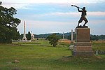
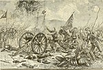
The High Water Mark of the Rebellion Monument is a Gettysburg Battlefield memorial which identifies the Confederate Army of Northern Virginia units of the infantry attack on the Battle of Gettysburg, third day, with a large bronze tablet, as well as the Union Army of the Potomac's "respective troops who met or assisted to repulse Longstreet's Assault." The memorial is named for the line of dead and wounded of Pickett's Charge which marked the deepest penetration into the Union line at The Angle when "4,500 men threw down their arms and came in as prisoners". The line is now generally marked with unit monuments which are also historic district contributing structures. The High Water Mark monument is accessible via Hancock Avenue which has parking spaces alongside, and a path leads to the site from a parking lot at the former Cyclorama Building at Gettysburg, which served for fifty years as a Gettysburg Battlefield visitor center by the National Park Service until it was demolished in 2013.
Excerpt from the Wikipedia article High Water Mark of the Rebellion Monument (License: CC BY-SA 3.0, Authors, Images).High Water Mark of the Rebellion Monument
Hancock Avenue,
Geographical coordinates (GPS) Address External links Nearby Places Show on map
Geographical coordinates (GPS)
| Latitude | Longitude |
|---|---|
| N 39.81245 ° | E -77.235716666667 ° |
Address
High Water Mark of the Rebellion
Hancock Avenue
17325
Pennsylvania, United States
Open on Google Maps


