place

Chillingham, Northumberland

Civil parishes in NorthumberlandNorthumberland geography stubsUse British English from August 2019Villages in Northumberland
Chillinghamherd
Chillinghamherd

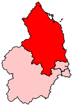
Chillingham is a village in Northumberland, England. It is situated approximately 6 km (3.7 mi) to the east of Wooler, south of Chatton. At the 2011 Census the population remained less than 100. Detailed information is included in the parish of Bewick. Chillingham is famous for its castle, which is said to be haunted, and the Chillingham Cattle, a wild herd of roughly 90 individuals which has been kept in an enclosure since the Middle Ages and strictly inbreeding for at least 300 years. The village contains Hebborn bastle house, a fortified house near Hepburn Wood.HMS Chillingham, a Ham class minesweeper, was named after the village. The civil parish, along with those for Chatton and Lilburn, has been served by Tillside Parish Council since 2003, under a grouping order by the former Borough of Berwick-upon-Tweed. According to Tillside Parish Council, two councillors represent Chillingham on the council.

Excerpt from the Wikipedia article Chillingham, Northumberland (License: CC BY-SA 3.0, Authors, Images).

Chillingham, Northumberland

Geographical coordinates (GPS) Address Nearby Places
placeShow on map

Wikipedia: Chillingham, NorthumberlandContinue reading on Wikipedia

Geographical coordinates (GPS)

Latitude Longitude
N 55.527 ° E -1.904 °
placeShow on map

Address


NE66 5NH
England, United Kingdom
mapOpen on Google Maps

Chillinghamherd
Chillinghamherd
Share experience

Nearby Places

Ros Hill
Ros Hill

Ros Hill, also known as Ros Castle due to the 3,000-year-old Iron Age hill fort on its summit, is a hill in the county of Northumberland in northern England. It is the highest point of a low range of hills stretching from Alnwick to Berwick-upon-Tweed — the Chillingham Hills. Other tops of the Chillingham Hills include Titlington Pike, Dod Law and Doddington Northmoor. However, Ros Hill is significantly higher than these and towers over the surrounding landscape with easily enough relative height to make it a "Marilyn". Ros Hill is situated just above Chillingham, with its famous herd of Chillingham cattle. Due to the wide enclosure of the cattle there are no paths on the western slopes, and the eastern slopes are featureless moor, so the best ascent option is to park at the summit of the minor road that crosses Hepburn Moor just to the south of the summit, giving a walk just over half a mile long and taking about half an hour. The summit is marked by a triangulation station and nearby there is a rather unusual walk-in toposcope built into the wall with four separate plaques. The view is panoramic and very extensive, and on a clear day, a total of seven castles can be seen from the summit, including the one on Holy Island. There is also a view over the cattle park to the north, while purple heather covers most of the surrounding area. This was a favourite location of Sir Edward Grey and after his death a part of the hill was acquired by public subscription and presented to the National Trust as part of a memorial to Grey. A plaque on the triangulation pillar records this.

Fowberry Tower
Fowberry Tower

Fowberry Tower is a Grade II* listed mansion house, situated on the banks of the River Till, near Chatton, Northumberland.The Manor of Fowberry was owned by the Fowberry family for over 400 years, and their 16th-century tower house incorporated the remains of an original pele tower. In the late 16th century Roger Fowberry mortgaged the estate to his neighbour William Strother of Kirknewton, and despite later legal attempts to dispute the debt, his son was obliged in 1591 to transfer the property to Lancelot Strother. The Strothers built a new manor house on the site in about 1666. When William Strother died in 1708 without a male heir the estate passed to William Kerr who married Blake’s heiress daughter. In 1776 their son John Strother Kerr sold the estate and house to Sir Francis Blake. Blake remodelled and substantially enlarged the house including delightful Strawberry Hill Gothic interiors; some of the more important interiors following this style in the North of England. He included the Blake family crest – a martlet surmounting a cap of maintenance – on a frieze in 22-carat gold leaf in the dining room. A new frontage was designed by the architect James Nesbit of Kelso. A feature of the new mansion was the creation of six false windows on the south elevation, which substantially improved the external appearance of the new building but avoided the burden of window tax. The Blakes sold the estate in 1807 to Matthew Culley (born 1778), son of the noted expert agriculturalist George Culley (born 1735). The design for the front of the house was continued and completed by Matthew Culley, who incorporated a dated medallion stone above the entrance, which reads 1809. A later George Culley of Fowberry was High Sheriff of Northumberland in 1867. The Culley family, later Leather Culley, remained at Fowberry until they sold the estate in 1920.

Eglingham
Eglingham

Eglingham is a village in Northumberland, England, situated about 7 miles (11 km) north-west of Alnwick and 10 miles (16 km) from Wooler. It lies in the sheltered valley of the Eglingham Burn, a tributary of the River Aln, about 100 metres (330 ft) above sea level, in a rural conservation area set amongst rolling countryside, within 5 miles (8 km) of the Cheviot Hills. The village is surrounded by mainly arable farmland, moorland and woodland, including an arboretum and some commercial forestry. The village has about 60 dwellings and a population of about 100, most situated either side of the through-road, and including the local manorial property, Eglingham Hall. Eglingham is also a parish, about nine miles (14 km) in length by four and a half in breadth, with an area of 23,361 acres (94.54 km2). It comprises 2 villages: South Charlton and Eglingham; and 4 settlements – Bassington, Ditchburn, Harehope, Shipley – and several smaller places. The River Breamish, which rises in the Cheviots, runs through the parish. The geological composition of the parish includes rich gravelly loam along the path of the river; clay predominating in the centre of the parish, and unenclosed moorland in the south and east. Within the moor area is Kimmer Loch, covering 10 acres (4.0 ha), and reputed to abound in perch and pike. The parish is largely agricultural, although gravel extraction continues to the west. Villages in the parish also serve as bases for commuters working in Alnwick and Newcastle upon Tyne.