place

Laurel Hill Cemetery

1836 establishments in PennsylvaniaArboreta in PennsylvaniaCemeteries in PhiladelphiaCemeteries on the National Register of Historic Places in PhiladelphiaEast Falls, Philadelphia
Historic American Buildings Survey in PhiladelphiaNational Historic Landmarks in PennsylvaniaPennsylvania state historical marker significationsRural cemeteriesTourist attractions in PhiladelphiaYellow fever monuments and memorials
LaurelHillCemeteryGatehouse(cropped) HABS314296cv

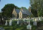
Laurel Hill Cemetery is a historic rural cemetery in the East Falls neighborhood of Philadelphia. Founded in 1836, it was the second major rural cemetery in the United States after Mount Auburn Cemetery in Boston, Massachusetts. The cemetery is 74-acre (300,000 m2) in size and overlooks the Schuylkill River. The cemetery grew to its current size through the purchase of four land parcels between 1836 and 1861. It contains over 11,000 family lots and more than 33,000 graves, including many adorned with grand marble and granite funerary monuments, elaborately sculpted hillside tombs and mausoleums. It is affiliated with West Laurel Hill Cemetery in nearby Bala Cynwyd, Pennsylvania and is an accredited arboretum with over 6,000 trees and shrubs representing 700 species. In 1977, Laurel Hill Cemetery was listed on the National Register of Historic Places and in 1998, became the first cemetery in the United States to be designated a National Historic Landmark.

Excerpt from the Wikipedia article Laurel Hill Cemetery (License: CC BY-SA 3.0, Authors, Images).

Laurel Hill Cemetery
Main Avenue, Philadelphia

Geographical coordinates (GPS) Address External links Nearby Places
placeShow on map

Wikipedia: Laurel Hill CemeteryContinue reading on Wikipedia

Geographical coordinates (GPS)

Latitude Longitude
N 40.003888888889 ° E -75.1875 °
placeShow on map

Address

Laurel Hill Cemetery

Main Avenue
19129 Philadelphia
Pennsylvania, United States
mapOpen on Google Maps

linkWikiData (Q6499849)
linkOpenStreetMap (14401359)

LaurelHillCemeteryGatehouse(cropped) HABS314296cv
Share experience

Nearby Places

Philadelphia and Reading Railroad, Schuylkill River Viaduct

The Philadelphia and Reading Railroad, Schuylkill River Viaduct, also called the Reading Railroad Bridge and the Falls Rail Bridge, is a stone arch bridge that carries rail traffic over the Schuylkill River at Falls of Schuylkill (East Falls) in Philadelphia, Pennsylvania. Located in Fairmount Park, the bridge also spans Martin Luther King, Jr., Drive, and Kelly Drive. The name Philadelphia & Reading Railroad (P&R) was later shortened to Reading Company. The current bridge replaced an adjacent P&R bridge, built of wood. Prior to that, one of the earliest suspension bridges in the United States, the 1808 Chain Bridge at Falls of Schuylkill (collapsed 1816), was built at this location. That was replaced by an 1818 covered bridge, built on the chain bridge's abutments, which washed away in 1822.The P&R built the viaduct, 1853–56, to carry coal cars to the company's coal terminal on the Delaware River in the Port Richmond neighborhood of Philadelphia. The bridge's design is unusual. Because it crosses the river at an oblique angle, it was constructed as a ribbed skew arch bridge, with each span composed of a series of offset stone arches. While not as strong as skewed barrel vault spans, these spans were much easier to build, while still assuring that the bridge's abutments were parallel to the water flow. The bridge consists of six main spans, each 78 feet (24 m) in length, crossing the river and Kelly Drive; five small arches, each 9 feet (2.7 m) in length, for pedestrian traffic; and a 30-foot (9.1 m) arch over Martin Luther King, Jr., Drive. The bridge's spandrel walls were reinforced in 1935. The bridge continues to carry rail traffic to this day.