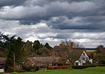
Stockton, Warwickshire
Use British English from June 2015Villages in Warwickshire

Stockton is a village and civil parish, in the Stratford-on-Avon district of Warwickshire, England. In the 2001 Census it had a population of 1,391, falling to 1,347 at the 2011 Census, then rising to 1,505 at the 2021 Census. The village is located just to the east of the A426 road two miles north-east of Southam, and eight miles south-west of Rugby. Stockton's name was first recorded in 1272, the name meaning 'a fenced enclosure'. During the 19th century, it developed as an industrial village.
Excerpt from the Wikipedia article Stockton, Warwickshire (License: CC BY-SA 3.0, Authors, Images).Stockton, Warwickshire
Rue Hobbema - Hobbemastraat, Stadt Brüssel
Geographical coordinates (GPS) Address Nearby Places Show on map
Geographical coordinates (GPS)
| Latitude | Longitude |
|---|---|
| N 52.27 ° | E -1.36153 ° |
Address
Rue Hobbema - Hobbemastraat 8
1000 Stadt Brüssel (Brüssel)
Belgien
Open on Google Maps


