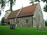
Bradfield Combust with Stanningfield
Borough of St EdmundsburyCivil parishes in SuffolkSuffolk geography stubs
Bradfield Combust with Stanningfield is a civil parish about 6 miles south of Bury St Edmunds, in the West Suffolk district of Suffolk, England. According to the 2001 census it had a population of 503, increasing to 578 at the Census 2011. The parish was formed in 1998 from Bradfield Combust and Stanningfield.
Excerpt from the Wikipedia article Bradfield Combust with Stanningfield (License: CC BY-SA 3.0, Authors).Bradfield Combust with Stanningfield
Bury Road, West Suffolk Bradfield Combust with Stanningfield
Geographical coordinates (GPS) Address Nearby Places Show on map
Geographical coordinates (GPS)
| Latitude | Longitude |
|---|---|
| N 52.179 ° | E 0.756 ° |
Address
Bury Road
Bury Road
IP29 4RR West Suffolk, Bradfield Combust with Stanningfield
England, United Kingdom
Open on Google Maps


