Poitiers (, UK also , US also , French: [pwatje] (listen); Poitevin: Poetàe) is a city on the River Clain in west-central France. It is a commune and the capital of the Vienne department and the historical centre of Poitou. In 2017 it had a population of 88,291. Its agglomeration has 130,853 inhabitants in 2016 and is the center of an urban area of 261,795 inhabitants.
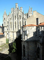
With more than 29,000 students, Poitiers has been a major university city since the creation of its university in 1431, having hosted René Descartes, Joachim du Bellay and François Rabelais, among others. A city of art and history, still known as "Ville aux cent clochers" the centre of town is picturesque and its streets include predominantly historical architecture and half-timbered houses, especially religious architecture, mostly from the Romanesque period ; including notably the Saint-Jean baptistery (4th century), the hypogeum of the Dunes (7th century), the Notre-Dame-la-Grande church (12th century), the Saint-Porchaire church (12th century) or the Saint-Pierre cathedral (end of the 12th century) as well as the courthouse (12th century), former palace of the Counts of Poitou, Dukes of Aquitaine, where the Queen of France and England Eleanor of Aquitaine held her court.
The city's name is associated with two major battles that took place in the area. The first, in 732, also known as the Battle of Tours (to avoid confusion with the second), saw the Franks commanded by Charles Martel defeat an expeditionary army of the Umayyad Caliphate. The second, in 1356, was one of the key battles of the Hundred Years' War. It saw the defeat of a larger French royal army by the English and the capture of John II by the victorious Prince of Wales.
The Poitiers agglomeration, located halfway between Paris and Bordeaux, is home to the Futuroscope technopole, which includes major public (CNED, Canopé, etc.) and private companies of national scope, as well as leading European research laboratories. With 2 million visitors annually, Futuroscope is the leading tourist site in Nouvelle-Aquitaine and the third most popular amusement park in France after Disneyland Paris and the Puy du Fou.


