Arrondissement of Nantes
Arrondissements of Loire-Atlantique

The arrondissement of Nantes is an arrondissement of France in the Loire-Atlantique department in the Pays de la Loire region. It has 76 communes. Its population is 830,509 (2016), and its area is 1,958.7 km2 (756.3 sq mi).
Excerpt from the Wikipedia article Arrondissement of Nantes (License: CC BY-SA 3.0, Authors, Images).Arrondissement of Nantes
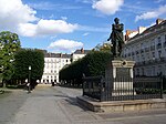
Boulevard Gabriel Guist'Hau, Nantes Centre Ville
Geographical coordinates (GPS) Address Nearby Places Show on map
Geographical coordinates (GPS)
| Latitude | Longitude |
|---|---|
| N 47.216666666667 ° | E -1.5666666666667 ° |
Address
Boulevard Gabriel Guist'Hau
44093 Nantes, Centre Ville
Pays de la Loire, France
Open on Google Maps


