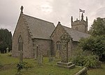
Carlidnack
Carlidnack (or Carlinack) is a hamlet in the parish of Mawnan, Cornwall, England. Carlidnack lies 2.7 miles (4.3 km) south-west of Falmouth on a road leading north-east from Mawnan Smith and at around 495 feet (151 m) above sea level.There is evidence of an ancient settlement at Carlidnack called a round that dates back to the late Iron Age or Roman period. This is a scheduled ancient monument that has been listed by English Heritage. The round is a circular area enclosed by a bank of earth and a ditch and with a single entrance; a round is usually a sign of an agricultural settlement. The round at Carlidnack has a bank that is 4 yards (3.7 m) high, a ditch that is 0.7 yards (0.64 m) deep and has a diameter of 140 yards (130 m); there are modern buildings on the site that date back to the early 20th century.
Excerpt from the Wikipedia article Carlidnack (License: CC BY-SA 3.0, Authors).Carlidnack
Carlidnack Road,
Geographical coordinates (GPS) Address Nearby Places Show on map
Geographical coordinates (GPS)
| Latitude | Longitude |
|---|---|
| N 50.121 ° | E -5.108 ° |
Address
Carlidnack Road
Carlidnack Road
TR11 5HA , Mawnan
England, United Kingdom
Open on Google Maps


