place

Calenick

Carrick geography stubsHamlets in Cornwall
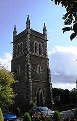
Calenick geograph.org.uk 229572

Calenick (Cornish: Klunyek) is a hamlet in the civil parish of Kea, about a mile south of Truro in Cornwall, England, UK. It is at the head of Calenick Creek, which opens into the River Truro near Sunny Corner.Calenick is also the name of a grade II* listed house and estate Calenick House. Circa 1702 The Newham Works opened (and were technically the first incarnation of Calenick, employing the first reverberatory furnace technology in Cornwall’s tin smelting industry). Smelting houses were sited close to coinage towns (Truro, before 1838 when coinage was abolished), with access to estuaries or the coast allowing for efficient import of coal and bricks. They required a source of water-power (waterwheels) to run the stamps used to crush the slag for re-smelting. Small ‘Calenick Crucibles‘ were manufactured in order to ‘assay’ or test the quantity of metal within the crushed ore. The crucibles resembled small china plant pots and were sold in nests like Russian dolls, exported as far as Australia and to other burgeoning tin mining economies. For this reason, Calenick House was once an important part of Cornwall's Tin Mining industry for both smelting and the manufacture of Calenick Crucibles. Further historical information can be found on Kea Parish Council's history pages as well as the history pages of Calenick House's own website.

Excerpt from the Wikipedia article Calenick (License: CC BY-SA 3.0, Authors, Images).

Geographical coordinates (GPS)

Latitude Longitude
N 50.2475 ° E -5.0578 °
placeShow on map

Address


TR3 6AA , Kea
England, United Kingdom
mapOpen on Google Maps

Calenick geograph.org.uk 229572
Share experience

Nearby Places

Calenick House
Calenick House

Calenick House (Cornish: Klunyek Chi) Calenick House is the principal part of a country house that forms a prominent collection of Grade II* listed buildings within the hamlet of Calenick, approximately 1 mile (1.6 km) south of the City of Truro in Cornwall. The site also houses a Grade II* clock tower, as well as a Grade II listed weigh house.Further detached buildings and ruins remain on the site which was once part of a tin smelting works. It is also the site of the manufacturing of Calenick Crucibles, which were a crucial part of the smelting process and were shipped worldwide, as far as Australia. Once the largest tin smelting blowing house, it had ten reverberatory furnaces by 1794. It is closely linked to the first known reverberatory furnace in Cornwall, at the nearby Newham Works (now known as Newham Industrial Estate) which transferred to the Calenick site in circa 1712. The site was in an advantageous position, near the head of Calenick Creek, with good access to water for power as well as an accessible route into the then coinage town of Truro. The site runs along the River Tinney which was once tidal to the western boundary of the site, however increased siltation of the creek, as well as changes in tides now see the river as a pleasant stream intersecting the hamlet. Calenick Bridge, at the head of the creek, is a grade II listed single-span bridge, built in the early 19th-century.The area was once subject to a historical investigation by Professor R. F. Tylecote of Newcastle University, who is generally recognised as the founder of the sub-discipline of archaeometallurgy.

Kea, Cornwall
Kea, Cornwall

Kea ( KEE; Cornish: Sen Ke) is a civil parish and village in Cornwall, England, United Kingdom. It is a "large straggling parish" in a former mining area south of Truro. Kea village is situated just over one mile (1.6 km) southwest of Truro.Old Kea is situated two miles (3 km) to the east on the west bank of the Truro River at grid reference SW 843 417. St Kea reputedly landed at Old Kea on his first visit to Cornwall and established a church there, which was the parish church until replaced by All Hallows. His life is described in the medieval Cornish language play Bewnans Ke (The Life of St Kea, c. 1550). Today, the parish is mainly agricultural, and is noted for giving its name to the damson-type Kea plum. It is bounded to the north by Calenick Creek and Truro civil parish; to the east by the Truro River and River Fal; to the south by the parishes of Feock, Perranarworthal and Gwennap; and to the west by Kenwyn. Other settlements in the parish include Calenick, Come-to-Good, Killiow, Nansavallan, Playing Place, Porth Kea, and the tiny hamlet of Quenchwell consisting of a few houses and a chapel. It takes its name from the Quench-well, a natural spring.Kea was described in 1870–72, John Marius Wilson's Imperial Gazetteer of England and Wales (1870) as: A parish and a sub-district in Truro district, Cornwall. The parish lies on the Falmouth and Redruth railways, 2¼ miles SSW of Truro; is bounded, on the E, by the river Fal, on the N, by Kenwyn, on the W, by Gwennap; and contains parts of the chapelries of Baldhu, Chacewater, and Mithian. Real property £7,158 of which £1,234 are in mines. Pop(ulation) in 1861 3,949. Houses, 824. The manor belongs to Viscount Falmouth.

Truro River
Truro River

The Truro River (Cornish: Hyldreth) is a river in the city of Truro in Cornwall, England, UK. It is the product of the convergence of the two rivers named Kenwyn and Allen which run under the city: the Truro River (named after the city) flows into the River Fal, estuarial waters where wildlife is abundant, and then out into the Carrick Roads. The river is navigable up to Truro. The river valleys form a bowl surrounding the city on the north, east and west and open to the Truro River in the south. The fairly steep-sided bowl in which Truro is located, along with high precipitation swelling the rivers and a spring tide in the River Fal, were major causes of flooding in 1988 which caused large amounts of damage to the city centre. Since then, flood defences have been constructed around the city, including an emergency dam at New Mill on the River Kenwyn and a tidal barrier on the Truro River, to prevent future problems. The valley of the Tresillian River is between the valleys of the Truro River and the Fal; the Tresillian River flows into the Truro River just upstream of where the latter joins the Fal. Early records give the Tresillian River the name "Seugar" (1297) or "Sowgar" (1530); the meaning of this name is unknown.The river is mentioned in the medieval Cornish language play Bewnans Ke (c. 1550), as the place from which the eponymous Saint Kea embarks for Rosené. It uses the river's Cornish name Hildrech, which in modern spelling is Hyldreth.