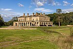
Broadhembury
East Devon DistrictVillages in Devon
Broadhembury is a village and civil parish in the East Devon district of Devon, England, 5 miles (8 km) north-west of Honiton.The civil parish includes the hamlets of Kerswell, Dulford, Crammer Barton, Colliton and Luton, all to the west of the village. According to the 2001 census the civil parish had a population of 654. Broadhembury is part of the electoral ward of Tale Vale. The total population of this ward at the 2011 Census was 2,514. It is within the Blackdown Hills Area of Outstanding Natural Beauty.
Excerpt from the Wikipedia article Broadhembury (License: CC BY-SA 3.0, Authors).Broadhembury
East Devon Broadhembury
Geographical coordinates (GPS) Address Nearby Places Show on map
Geographical coordinates (GPS)
| Latitude | Longitude |
|---|---|
| N 50.835556 ° | E -3.2775 ° |
Address
EX14 3ND East Devon, Broadhembury
England, United Kingdom
Open on Google Maps


