Sheldon, Devon
Civil parishes in DevonDevon geography stubsEast Devon DistrictVillages in Devon

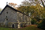
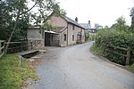
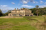
Sheldon is a village and civil parish in the East Devon district of the county of Devon in England. It is located in the Blackdown Hills, 6.5 miles (10.5 km) north-northwest of Honiton. In the 2011 UK census, its population was recorded as 189 persons, with an average (mean) age of 45.The parish church, the Church of St James the Greater, is a Grade II listed building with a Norman font and a 15th-century tower.
Excerpt from the Wikipedia article Sheldon, Devon (License: CC BY-SA 3.0, Authors, Images).Sheldon, Devon
Church Lane, East Devon Sheldon
Geographical coordinates (GPS) Address Nearby Places Show on map
Geographical coordinates (GPS)
| Latitude | Longitude |
|---|---|
| N 50.87 ° | E -3.253 ° |
Address
Church Lane
Church Lane
EX14 4QT East Devon, Sheldon
England, United Kingdom
Open on Google Maps


