Awliscombe
Devon geography stubsOpenDomesdayVillages in Devon

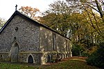
Awliscombe is a village and civil parish in the East Devon district of Devon, England. The village is about two miles west of Honiton. The 2011 census showed a population of 500 for the parish, which is surrounded clockwise from the north by the parishes of Dunkeswell, Combe Raleigh, Honiton, Gittisham, Buckerell, Payhembury and Broadhembury.In the centre of the village is the church of St Michael & All Angels and Awliscombe C of E Primary School.The village has been described as having "a fine show of medieval stonework", and the church screen as being "one of the splendid survivals of the best craftsmanship of medieval Devon".
Excerpt from the Wikipedia article Awliscombe (License: CC BY-SA 3.0, Authors, Images).Awliscombe
East Devon Awliscombe
Geographical coordinates (GPS) Address Nearby Places Show on map
Geographical coordinates (GPS)
| Latitude | Longitude |
|---|---|
| N 50.816667 ° | E -3.233333 ° |
Address
EX14 3PR East Devon, Awliscombe
England, United Kingdom
Open on Google Maps


