place

Rotbach (Dreisam)

Rivers of Baden-WürttembergRivers of GermanyRivers of the Black ForestTributaries of the Elz (Rhine)
54, Falkenstein Höllental

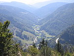
The Rotbach (in its upper reaches it is called the Zartenbach and Löffeltalbach, in its middle section, the Höllenbach) is the 19.9-kilometre-long, left-hand and southeasterly headstream of the Dreisam in the Southern Black Forest in the south German state of Baden-Württemberg.

Excerpt from the Wikipedia article Rotbach (Dreisam) (License: CC BY-SA 3.0, Authors, Images).

Rotbach (Dreisam)
Stucken, Verwaltungsgemeinschaft Hinterzarten

Geographical coordinates (GPS) Address Nearby Places
placeShow on map

Wikipedia: Rotbach (Dreisam)Continue reading on Wikipedia

Geographical coordinates (GPS)

Latitude Longitude
N 47.88528 ° E 8.08528 °
placeShow on map

Address

Stucken
79856 Verwaltungsgemeinschaft Hinterzarten
Baden-Württemberg, Germany
mapOpen on Google Maps

54, Falkenstein Höllental
Share experience

Nearby Places

Ravenna Gorge
Ravenna Gorge

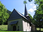
The Ravenna Gorge (German: Ravennaschlucht) is a gorge in the Black Forest in southwest Germany. It is a narrow side valley of the Höllental, through which the Ravenna stream flows. A trail also runs through the ravine as part of the Black Forest Homeland Path (Heimatpfad Hochschwarzwald). The roughly four-kilometre-long gorge runs from the Höllental up to the village of Breitnau on the plateau and lies within its municipal boundaries. The name of the gorge is probably derived from the French word ravine which means "gorge".The wild mountain brook of the Ravenna tumbles over several waterfalls in the gorge. The two biggest falls are the Great Ravenna Fall (Großer Ravennafall) which is 16 metres high and the Little Ravenna Fall (Kleiner Ravennafall) which descends through a height of 6 metres. In former times, there were several water mills along the stream. Some are still visible today within the gorge and one or two are well preserved. At the upper end of the gorge is the mill of Großjockenmühle which dates to 1883 and is a protected monument. A feature of this mill is that, due to the steep descent of the Ravenna, the water is led over the roof of the mill onto the water wheel. The lower part of the gorge is spanned by the 37-metre-high Ravenna Bridge, the viaduct of the Höllental Railway. Also here is Saint Oswald’s Chapel (built 1148) and the Hotel Hofgut Sternen, in which Marie Antoinette stayed in 1770 and Goethe in 1779. In front of the Ravenna Bridge is the Galgenbühl, a knoll about 30 metres high. There used to be a gallows (Galgen) here, where executions were carried out. Later a pavilion was built here which fell into ruins over the course of time. The slopes were originally used as pasture, but in the 1950s the mountain was afforested with spruce and Douglas fir. In 2010 all the trees were felled, however, and a new pavilion erected on the Galgenbühl. It is covered with shingles made of thuja wood.

Windgfällweiher
Windgfällweiher

The Windgfällweiher is a reservoir between the Titisee and the Schluchsee in the south of Baden-Württemberg, Germany. It is located within the High Black Forest and lies in a hollow formed by ice age glaciation between the villages of Altglashütten, Falkau and Aha on the territory of the municipality of Lenzkirch. The lake lies in a trough that runs from the Seebach valley in the northwest to the Schluchsee in the southeast and thus crosses the generally northeastward-running streams in the area. This remnant of a former valley is followed by the Three Lakes Railway that was built between 1920 and 1926 and by the transfer channel (Überleitungskanal), built in 1932 and belonging to the Schluchseewerk, which takes water from the Seebach valley via the Haslach valley to the Schluchsee Basin. North of the low-lying watershed in this trough, between the Haslach in the north and the Ahabach in the south, now drowned by the impounded Schluchsee, the glacier of the last ice age carved out a basin, in which a small bog lake formed, the natural precursor to today's reservoir. This was enlarged in 1895 by the former Falkau Screw Works (Schraubenfabrik Falkau) with a dam in the north and the water surface raised by about 6 metres. At the same time the lake, which had only hitherto been fed from the east by the Kähnerbächle, was given another inflow in the form of a small leat (Hangkanal) from the southwest. Since 1932 the Windgfällweiher has been incorporated into the transfer of water from the Seebach to the Schluchsee (covered leat) and drained since then in the opposite direction i.e. to the south. The water is led via a ditch over the low watershed, initially as the Windgefällbach and later, the Schwarzach, into the Schluchsee. Since 1950 the lake has been protected. In 2002 an angling and fish consumption ban was announced, because PCB had been discovered in the sediment depositions on the bottom of the lake.On the wooded eastern shore of the Windgfällweiher, a lake barely touched by the streams of visitors to the area, lies a rather less picturesque bathing beach with a listed building.The Windgfällweiher, together with the Schluchsee and Titisee, contributed to the name of the Three Lakes Railway.