Mala Štanga
Osrednjeslovenska statistical region geography stubsPages with Slovene IPAPopulated places in the Municipality of Šmartno pri Litiji

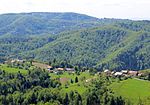
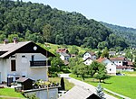
Mala Štanga (pronounced [ˈmaːla ˈʃtaːŋɡa]; German: Stangenwald, Stangen) is a small dispersed settlement in the Municipality of Šmartno pri Litiji in central Slovenia. It lies in the Sava Hills (Slovene: Posavsko hribovje) west of Litija. The area is part of the historical region of Lower Carniola. The municipality is now included in the Central Slovenia Statistical Region.An Early Iron Age hillfort has been identified on a hill to the east of the settlement, although the usual associated burial ground has yet to be found.
Excerpt from the Wikipedia article Mala Štanga (License: CC BY-SA 3.0, Authors, Images).Mala Štanga
Upravna Enota Litija
Geographical coordinates (GPS) Address Nearby Places Show on map
Geographical coordinates (GPS)
| Latitude | Longitude |
|---|---|
| N 46.059930555556 ° | E 14.753911111111 ° |
Address
1281 Upravna Enota Litija
Slovenia
Open on Google Maps


