place

Bugthorpe

Civil parishes in the East Riding of YorkshireOpenDomesdayUse British English from November 2014Villages in the East Riding of Yorkshire
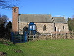
St. Andrew's Church, Bugthorpe geograph.org.uk 389754

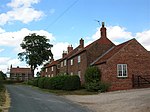
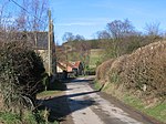
Bugthorpe is a village and civil parish in the East Riding of Yorkshire, England, about 11 miles (18 km) east of York and 16 miles (26 km) west of Driffield. The village is just south of the border with North Yorkshire. According to the 2011 UK Census the civil parish had a population of 103, a decrease on the 2001 UK Census figure of 122.St Andrew's Church stands in the village and was designated a Grade I listed building in 1966 and is now recorded in the National Heritage List for England, maintained by Historic England. Next to the church is the village green. Low Hall is also designated as a Grade II* listed building.There are road links from the village to Skirpenbeck, Barthorpe Bottoms, Kirby Underdale, and the main A166 York to Bridlington road. Bugthorpe has a village post office, a brewery and a small school.

Excerpt from the Wikipedia article Bugthorpe (License: CC BY-SA 3.0, Authors, Images).

Bugthorpe
Main Street,

Geographical coordinates (GPS) Address Nearby Places
placeShow on map

Wikipedia: BugthorpeContinue reading on Wikipedia

Geographical coordinates (GPS)

Latitude Longitude
N 54.011634 ° E -0.823619 °
placeShow on map

Address

Main Street
YO41 1QG , Bugthorpe
England, United Kingdom
mapOpen on Google Maps

St. Andrew's Church, Bugthorpe geograph.org.uk 389754
Share experience

Nearby Places

Skirpenbeck
Skirpenbeck

Skirpenbeck is a village and civil parish in the East Riding of Yorkshire, England. It is situated 2 miles (3.2 km) north-west of Stamford Bridge just north of the A166 road. According to the 2011 UK census, Skirpenbeck parish had a population of 192, an increase on the 2001 UK census figure of 142. In 2019 this was estimated to be 304. The place-name 'Skirpenbeck' is first attested in the Domesday Book of 1086, where it appears as Scarpenbec. It derives from the Old Norse skerping and bekkr, meaning barren land by a beck or stream.Skirpenbeck is near Stamford Bridge, over the River Derwent, near where King Harold of England defeated Harald Hardrada King of Norway in 1066. Its first baron was Sir William de Chauncy, son of Chauncy de Chauncy. Unusually for a village there are a still number of working farms in the village, some of which have been farmed by the same families for generations. There are currently 7 working farms in the village. The parish church of St Mary's is a Grade II* listed building.There are markings on the church building (near the bell tower) that appear to be Saxon runes. The village has also had some notable residents: Alick Walker the palaeontologist was born in Skirpenbeck.Thomas Cooke the machinist was the school Headmaster in Skirpenbeck where he also created precision scientific instruments such as microscopes and telescopes.Frederick James Lloyd, more commonly known as James Lloyd, was an English artist. He became famous for his paintings, mostly of animals and country landscapes. He was the first living self-taught artist to have a painting hung at the Tate in London, titled Cat and Mouse. He and his family moved to Skirpenbeck in 1950 where he took on the job as a cowman. There were now so many paintings, laboriously constructed dot by dot (pointillism). His wife Nancy decided it was time that Lloyd's work was seen by more people. Without telling her husband she wrote to Sir Herbert Read and he paid Lloyd a visit to see his paintings, and bought a couple of them. Herbert Read sent some to various galleries in London. In 1958 Lloyd held his first one-man show at (the late) Arthur Jeffress Gallery in London. All but 2 of the 32 paintings being held were sold within hours of opening.

Fangfoss
Fangfoss

Fangfoss is a village and civil parish in the East Riding of Yorkshire, England. It is situated approximately 11 miles (18 km) to the east of the city of York and 3.5 miles (6 km) north-west of the town of Pocklington. The parish includes Bolton. The civil parish is called "Fangfoss" and its parish council is called "Fangfoss with Bolton Parish Council" after Bolton parish was abolished on 1 April 1935 and merged with Fangfoss. The parish covers an area of 900.98 hectares (2,226.4 acres). In 2011 it had a population of 581, a decrease on the 2001 UK census figure of 602.In 1823 Fangfoss was listed as the parish of 'Fangfoss-with-Spittle'. The village was in the Wapentake of Harthill. Population was 154, with occupations including twelve farmers, a shopkeeper, a shoemaker, and a schoolmaster. The landlord of The Carpenter's public house was also a village carpenter. The village chapel was in the charge of the vicar of Barnby-upon-the-Moor, and under the patronage of the Dean of York. The parish church of St Martin was designated a Grade II* listed building in January 1967 and is now recorded in the National Heritage List for England, maintained by Historic England.Fangfoss Hall was designated a Grade II* listed building in 1967 and is now recorded in the National Heritage List for England, maintained by Historic England. Fangfoss was served by Fangfoss railway station on the York to Beverley Line between 1847 and 1959. In 1987 the station was given a Grade II listed building status.In addition to the parish church, Fangfoss has a primary school and pub called The Carpenters Arms. A village park was created in 2002 to mark the Queen's Golden Jubilee and is called Jubilee Park.Fangfoss hosts an annual arts festival called Fangfest.