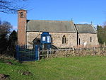
Youlthorpe
East Riding of Yorkshire geography stubsOpenDomesdayUse British English from June 2015Villages in the East Riding of Yorkshire

Youlthorpe is a hamlet in the East Riding of Yorkshire, England. It forms part of the civil parish of Bishop Wilton. It is situated approximately 10 miles (16 km) east of York, 5 miles (8 km) north-west of Pocklington and just south of the main A166 road from York to Bridlington. From 1886 Youlthorpe was part of the civil parish of Youlthorpe with Gowthorpe which was abolished on 1 April 1935 with the creation of the civil parish of Bishop Wilton.East farmhouse in the settlement was designated a Grade II listed building in 1987 and is now recorded in the National Heritage List for England, maintained by Historic England.
Excerpt from the Wikipedia article Youlthorpe (License: CC BY-SA 3.0, Authors, Images).Youlthorpe
Awnhams Lane,
Geographical coordinates (GPS) Address Nearby Places Show on map
Geographical coordinates (GPS)
| Latitude | Longitude |
|---|---|
| N 53.990091 ° | E -0.831212 ° |
Address
Awnhams Lane
Awnhams Lane
YO41 5QW , Bishop Wilton
England, United Kingdom
Open on Google Maps


