Bourton, Vale of White Horse
Civil parishes in OxfordshireUse British English from August 2015Villages in Oxfordshire

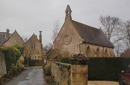
Bourton is a village and civil parish in the Vale of White Horse about 4 miles (6.4 km) southeast of Highworth in neighbouring Wiltshire. The western boundary of the parish is a stream that also forms the county boundary. Bourton was part of the parish of Shrivenham until 1867. Bourton was part of Berkshire until the 1974 local government boundary changes transferred the Vale of White Horse to Oxfordshire. The 2011 Census recorded the parish population as 326.
Excerpt from the Wikipedia article Bourton, Vale of White Horse (License: CC BY-SA 3.0, Authors, Images).Bourton, Vale of White Horse
The Hill, Vale of White Horse
Geographical coordinates (GPS) Address Phone number Website Nearby Places Show on map
Geographical coordinates (GPS)
| Latitude | Longitude |
|---|---|
| N 51.582 ° | E -1.667 ° |
Address
Pinewood School
The Hill
SN6 8HZ Vale of White Horse
England, United Kingdom
Open on Google Maps


