Pilat Regional Natural Park
European protected area stubsGeography of Auvergne-Rhône-AlpesGeography of Loire (department)Geography of Rhône (department)Protected areas established in 1974 ... and 4 more
Regional natural parks of FranceTourist attractions in Auvergne-Rhône-AlpesTourist attractions in Loire (department)Tourist attractions in Rhône (department)

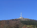
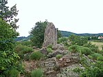
Pilat Regional Natural Park (French: Parc naturel régional du Pilat) is a protected area of mountainous countryside in the Auvergne-Rhône-Alpes region of southeastern France. The park spans the departments of Loire and Rhône, and covers a total area of 65,000 hectares (160,000 acres).The mountain terrain ranges from 140 metres (460 ft) to 1,432 metres (4,698 ft) in elevation. Forty-seven communes dot the landscape, with approximately fifty thousand residents. The land was officially designated a regional natural park in 1974.
Excerpt from the Wikipedia article Pilat Regional Natural Park (License: CC BY-SA 3.0, Authors, Images).Pilat Regional Natural Park
Sentier Claude Berthier, Saint-Étienne
Geographical coordinates (GPS) Address Nearby Places Show on map
Geographical coordinates (GPS)
| Latitude | Longitude |
|---|---|
| N 45.393888888889 ° | E 4.5858333333333 ° |
Address
Sentier Claude Berthier
Sentier Claude Berthier
42740 Saint-Étienne
Auvergne-Rhône-Alpes, France
Open on Google Maps


