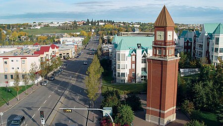
St. Albert, Alberta
1861 establishments in the British Empire1899 establishments in the Northwest TerritoriesCities in AlbertaEdmonton Metropolitan RegionFormer new towns in Alberta ... and 1 more
St. Albert, Alberta

St. Albert is a city in Alberta on the Sturgeon River northwest of the City of Edmonton. It was originally settled as a Métis community, and is now the second-largest city in the Edmonton Metropolitan Region. St. Albert first received its town status in 1904 and was reached by the Canadian Northern Railway in 1906. Originally separated from Edmonton by several miles of farmland, the 1980s expansion of Edmonton's city limits placed St. Albert immediately adjacent to the larger city on St. Albert's south and east sides.
Excerpt from the Wikipedia article St. Albert, Alberta (License: CC BY-SA 3.0, Authors, Images).St. Albert, Alberta
Sturgeon Road, St. Albert
Geographical coordinates (GPS) Address Nearby Places Show on map
Geographical coordinates (GPS)
| Latitude | Longitude |
|---|---|
| N 53.636944444444 ° | E -113.62027777778 ° |
Address
Sturgeon Road 30
T8N 1C7 St. Albert
Alberta, Canada
Open on Google Maps


