Nanclares de la Oca

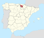
Nanclares de la Oca (Spanish pronunciation: [naŋˈklaɾes ðe la ˈoka]) or Langraiz Oka (Basque pronunciation: [langrais̻ oka]) is a village and concejo in the province of Álava, in the Basque Country, Spain. It is also the seat of the municipality of Iruña de Oca and the most populated settlement in the Cuadrilla de Añana comarca. The village is located in the western part of the Llanada Alavesa, roughly 12 kilometres (7.5 mi) away from the capital of the Basque Country, Vitoria-Gasteiz. It was an independent municipality (consisting of Nanclares de la Oca itself, Montevite and Ollávarre) until 1976, when it was merged with Iruña to form the current municipality of Iruña de Oca.
Excerpt from the Wikipedia article Nanclares de la Oca (License: CC BY-SA 3.0, Authors, Images).Nanclares de la Oca
Langraiz hiribidea/Avenida de Nanclares, Iruña Oka/Iruña de Oca
Geographical coordinates (GPS) Address Nearby Places Show on map
Geographical coordinates (GPS)
| Latitude | Longitude |
|---|---|
| N 42.81783 ° | E -2.80814 ° |
Address
Langraiz hiribidea/Avenida de Nanclares 14
01230 Iruña Oka/Iruña de Oca
Autonomous Community of the Basque Country, Spain
Open on Google Maps


