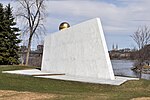
Victoria Island (Ottawa River)

Victoria Island (French: Île Victoria, Algonquin: Asinabka) is an island in the Ottawa River, located north of LeBreton Flats, 1 km west of Parliament Hill in Ottawa, Ontario, Canada. The island is "a place of special significance" to the local Algonquian peoples, who use the island for ceremonial purposes and for protests. It is part of an archipelago of islands below Chaudière Falls, which also includes the former Philemon Island, Chaudière Island, Amelia Island and Albert Island.Both the Portage Bridge and Chaudière Bridge cross the island, connecting Ottawa to Gatineau, Quebec on the other side of the river. Otherwise, public access to the island is currently restricted due to an environmental remediation project set to be completed in 2025. The project is projected to cost $13 million.
Excerpt from the Wikipedia article Victoria Island (Ottawa River) (License: CC BY-SA 3.0, Authors, Images).Victoria Island (Ottawa River)
Portage Bridge, (Old) Ottawa Somerset
Geographical coordinates (GPS) Address Nearby Places Show on map
Geographical coordinates (GPS)
| Latitude | Longitude |
|---|---|
| N 45.420833333333 ° | E -75.712777777778 ° |
Address
Pont du Portage Bridge
Portage Bridge
K1R 1C5 (Old) Ottawa, Somerset
Ontario, Canada
Open on Google Maps


