Bachelor Island (Washington)

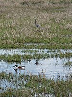
Bachelor Island is an island in the U.S. state of Washington. It is located in the Columbia River near Ridgefield, just south of the mouth of the Lewis River and a few miles north of the mouth of the Willamette River. The island stretches from Columbia river mile 88 to 91.5 (142 to 147 km). The northern end of Sauvie Island lies across the Columbia from Bachelor Island.Bachelor Island is separated from the mainland by Bachelor Island Slough and Lake River. Bachelor Island Slough separates from the Columbia River at Bachelor Point and the southern end of Bachelor Island. The slough joins Lake River, which empties into the Columbia River at the northern end of Bachelor Island.Most of Bachelor Island is part of the Ridgefield National Wildlife Refuge.
Excerpt from the Wikipedia article Bachelor Island (Washington) (License: CC BY-SA 3.0, Authors, Images).Bachelor Island (Washington)
Smith Lake Road,
Geographical coordinates (GPS) Address Nearby Places Show on map
Geographical coordinates (GPS)
| Latitude | Longitude |
|---|---|
| N 45.820833333333 ° | E -122.77638888889 ° |
Address
Smith Lake Road
Smith Lake Road
Washington, United States
Open on Google Maps


