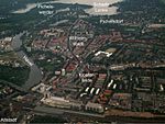
Heerstraße (Berlin)
Charlottenburg-WilmersdorfSpandauStreets in Berlin

Heerstraße (German pronunciation: [ˈheːɐ̯ˌʃtʁaːsə] (listen); literally: Army Street) runs from Theodor-Heuss-Platz in Berlin-Charlottenburg to the western city border of Berlin in the locality of Staaken in the borough of Spandau. It is part of Bundesstraße 5; from Theodor-Heuss-Platz to Wilhelmstraße it is forms part of Bundesstraße 2. With a length of around 10 kilometres, it is one of the longest streets in Berlin and an important commuter route. The street is a five-lane expressway (Kraftfahrstraße), depending on traffic flow the middle lane is available during rush hours in the morning (eastbound) and in the evening (westbound).
Excerpt from the Wikipedia article Heerstraße (Berlin) (License: CC BY-SA 3.0, Authors, Images).Heerstraße (Berlin)
Heerstraße, Berlin Wilhelmstadt
Geographical coordinates (GPS) Address Nearby Places Show on map
Geographical coordinates (GPS)
| Latitude | Longitude |
|---|---|
| N 52.513333333333 ° | E 13.195277777778 ° |
Address
Heerstraße 227
13595 Berlin, Wilhelmstadt
Germany
Open on Google Maps


