place

Ravenscroft Hall

1877 establishments in EnglandCheshire building and structure stubsCountry houses in CheshireGrade II listed buildings in CheshireGrade II listed houses
Houses completed in 1837Houses completed in 1877United Kingdom listed building stubs
The Many Chimneys of Ravenscroft Hall (geograph 3847670)

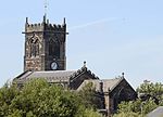
Ravenscroft Hall is a country house standing to the east of the B5309 road (King Street) about 1 mile (1.6 km) to the north of Middlewich, Cheshire, England. The house was built in 1837 for William T. Buchanan, replacing a former Jacobean house. It was extended, possibly in 1852 when the house was bought by the Moss family, and again in 1877. The house has since been divided into two dwellings. It is constructed in roughcast and yellow brick, with stone dressings and slate roofs. The house is in two storeys, with a main front of five bays, and a five-bay extension to the northeast. The garden front also has five bays. The house has an Ionic porch, and an Italianate belvedere. It is recorded in the National Heritage List for England as a designated Grade II listed building.

Excerpt from the Wikipedia article Ravenscroft Hall (License: CC BY-SA 3.0, Authors, Images).

Ravenscroft Hall
King Street,

Geographical coordinates (GPS) Address Nearby Places
placeShow on map

Wikipedia: Ravenscroft HallContinue reading on Wikipedia

Geographical coordinates (GPS)

Latitude Longitude
N 53.20479 ° E -2.44564 °
placeShow on map

Address

King Street

King Street
CW10 9LD
England, United Kingdom
mapOpen on Google Maps

The Many Chimneys of Ravenscroft Hall (geograph 3847670)
Share experience

Nearby Places

Cheshire Plain
Cheshire Plain

The Cheshire Plain is a relatively flat expanse of lowland within the county of Cheshire in North West England but extending south into Shropshire. It extends from the Mersey Valley in the north to the Shropshire Hills in the south, bounded by the hills of North Wales to the west and the foothills of the Pennines to the north-east. The Wirral Peninsula lies to the north-west whilst the plain merges with the South Lancashire Plain in the embayment occupied by Manchester to the north. In detail, the plain comprises two areas with distinct characters, the one to the west of the Mid Cheshire Ridge and the other, larger part, to its east. The plain is the surface expression of the Cheshire Basin, a deep sedimentary basin that extends north into Lancashire and south into Shropshire. It assumed its current form as the ice-sheets of the last glacial period melted away between 20,000 and 15,000 years ago leaving behind a thick cover of glacial till and extensive tracts of glacio-fluvial sand and gravel. The primary agricultural use of the Cheshire Plain is dairy farming, creating the general appearance of enclosed hedgerow fields. Meteorologists use the term Cheshire Gap when referring to the lowlands of the Cheshire Plain, providing as they do a passage between the Clwydian Hills, in Wales on the one hand and the Peak District and South Pennines on the other. Weather systems are often guided down this "gap", penetrating much further inland than elsewhere along the coast of the Irish Sea.