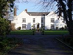
Betchton
Cheshire geography stubsCivil parishes in CheshireVillages in Cheshire
Betchton is a civil parish in the unitary authority of Cheshire East and the ceremonial county of Cheshire, England. According to the 2001 census it had a population of 620, increasing to 677 at the 2011 Census. The parish is immediately to the east of Sandbach, and includes Betchton Heath, Malkin's Bank and Hassall Green. The parish elects 10 councillors to the parish council.
Excerpt from the Wikipedia article Betchton (License: CC BY-SA 3.0, Authors).Betchton
Smithy Grove,
Geographical coordinates (GPS) Address Nearby Places Show on map
Geographical coordinates (GPS)
| Latitude | Longitude |
|---|---|
| N 53.124069 ° | E -2.329085 ° |
Address
Smithy Grove
Smithy Grove
CW11 4YA , Betchton
England, United Kingdom
Open on Google Maps


