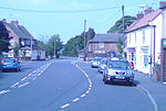
Besthorpe, Nottinghamshire
Newark and SherwoodVillages in Nottinghamshire

Besthorpe is a small village in north-east Nottinghamshire close to the border with Lincolnshire. It is a Civil Parish in the Newark & Sherwood district of Nottinghamshire. The population of the civil parish as of the 2011 census is 195. The village is on the A1133 between Newark and Gainsborough, and is 1.5 miles north of the larger village of Collingham, north east of Newark on Trent. The village lies 1 mile east of the River Trent and the River Fleet flows south to east parallel with the village & A1133. Besthorpe acquired Conservation Village status in 2006 because it has maintained much of its original layout focused on Low Road and the Green.
Excerpt from the Wikipedia article Besthorpe, Nottinghamshire (License: CC BY-SA 3.0, Authors, Images).Besthorpe, Nottinghamshire
Low Road, Newark and Sherwood
Geographical coordinates (GPS) Address Nearby Places Show on map
Geographical coordinates (GPS)
| Latitude | Longitude |
|---|---|
| N 53.173 ° | E -0.767 ° |
Address
Low Road
NG23 7FL Newark and Sherwood
England, United Kingdom
Open on Google Maps


