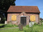
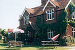
Billingshurst
Use British English from August 2019Villages in West Sussex

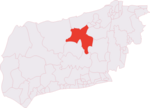
Billingshurst is a village and civil parish in the Horsham District of West Sussex, England. The village lies on the A29 road (the Roman Stane Street) at its crossroads with the A272, 6 miles (10 km) south-west of Horsham and 5.5 miles (9 km) north-east of Pulborough. The civil parish has a land area of 7,952 acres (3,218 hectares) and at the 2001 Census had 2,677 households and a population of 6,531 people, which increased to 8,232 at the 2011 Census.
Excerpt from the Wikipedia article Billingshurst (License: CC BY-SA 3.0, Authors, Images).Billingshurst
St Mary's Close,
Geographical coordinates (GPS) Address Nearby Places Show on map
Geographical coordinates (GPS)
| Latitude | Longitude |
|---|---|
| N 51.0226 ° | E -0.4508 ° |
Address
St Mary's Close
RH14 9UA , Billingshurst
England, United Kingdom
Open on Google Maps


