place

Bawburgh

Civil parishes in NorfolkSouth NorfolkVillages in Norfolk
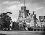
Bawburgh 031858 ddf5ad4a by Katy Walters

Bawburgh () is a village and civil parish in the South Norfolk district of Norfolk, England, lying in the valley of the River Yare about 5 miles (8.0 km) west of Norwich city centre. According to the 2001 census it had a population of 466, increasing to 595 at the 2011 census. Bawburgh is very close to the relatively new Norfolk and Norwich University Hospital and the Bowthorpe Estate. The name is first recorded as Bauenburc in 1086 and is from Old English 'stronghold of a man called Beawa.'The mill at the centre of the village was the original site of the manufacture of Colman's mustard. There is a pub called The King's Head. Bawburgh is a significant location in the legend of St Walstan, the 10th-11th century patron saint of farm labourers. According to legend, Walstan was born at Bawburgh (or possibly Blythburgh in Suffolk) into a Saxon noble family circa 970, but at the age of 12 gave up his privileged life, choosing instead to work as a farm labourer in Taverham. His initial journey on foot from Bawburgh to Taverham took Walstan through Costessey, where he donated his noble garments to two passing peasants. After many years, Walstan's imminent death was foretold by an angel and he asked a priest for the last rites; no water was available but a miraculous spring welled up on the spot. On his death, Walstan's body was returned to Bawburgh on a cart drawn by two white oxen. The oxen stopped at Costessey, where a second spring gushed forth and at Bawburgh, where a third spring appeared. St Walstan's Well at Bawburgh is the only one of the legendary springs that remains identifiable. Walstan's body was taken into the church and Bawburgh became the centre of a cult of pilgrimage, with several miracles recorded.

Excerpt from the Wikipedia article Bawburgh (License: CC BY-SA 3.0, Authors, Images).

Geographical coordinates (GPS)

Latitude Longitude
N 52.6333 ° E 1.1833 °
placeShow on map

Address

The Kings Head

Harts Lane
NR9 3LS Norwich
England, United Kingdom
mapOpen on Google Maps

Phone number

call+441603744977

Website
kingshead-bawburgh.co.uk

linkVisit website

Bawburgh 031858 ddf5ad4a by Katy Walters
Share experience

Nearby Places

Bowthorpe

Bowthorpe is a suburban village to the west of Norwich, in the county of Norfolk, England. It is primarily a residential area, but includes a large industrial estate (Bowthorpe Industrial Estate; occupied by mix-use commercial business, including the technology sector) and one small out-of-town shopping centre, containing a supermarket and various smaller retail outlets. A community hall is situated close to Bowthorpe village centre. A police station was located near the centre until it closed in 2018. Most of present-day Bowthorpe has been developed from the 1970s onward. The villages name means either 'Bui's outlying farm/settlement' or 'bow farm/settlement'. Bowthorpe is divided into four distinct areas: Clover Hill Chapel Break Three Score Bowthorpe Industrial EstateThe largest of these areas is Clover Hill, a mix of council development and private housing, making up almost two-thirds of Bowthorpe. Clover Hill, situated to the east of the other three areas was developed in the 1970s and 1980s. Further development of the mainly private housing estates, Chapel Break and Three Score took place in the 1990s and early 2000s. In 1549, Robert Kett briefly camped at Bowthorpe at the beginning of the rebellion that was to bear his name. On 10 July 1549, the Sheriff of Norfolk: Sir Edward Wyndham, was nearly pulled from his house by the rebels in the village as he tried to persuade them to disband. This helped to inspire further people from Norwich to join Kett at his camp in the village. Kett quickly decided that Bowthorpe was too exposed for a rebel camp, and moved on to Mousehold Heath.Bowthorpe differs from the nearby estates of Earlham and Costessey; by having a high variability of housing stock, and a centrally planned network of bus and bicycle-only lanes. Large open spaces and parks border the periphery of the Bowthorpe housing estate, with Bowthorpe Park between the north of the estate and Dereham Road, and the Yare Marshland and Bowthorpe Southern Park bordering the south and west of the estate.