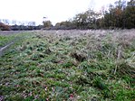
Bardon, Leicestershire
Civil parishes in LeicestershireFormer populated places in LeicestershireNorth West Leicestershire DistrictUse British English from June 2016

Bardon is a civil parish and former village in North West Leicestershire about 1.5 miles (2.4 km) southeast of the centre of Coalville. The parish includes Bardon Hill, which at 912 feet (278 m) above sea level is the highest point in Leicestershire. With the population remaining less than 100, information from the 2011 census was included in the civil parish of Ellistown and Battleflat.
Excerpt from the Wikipedia article Bardon, Leicestershire (License: CC BY-SA 3.0, Authors, Images).Bardon, Leicestershire
A511, North West Leicestershire Ellistown and Battleflat
Geographical coordinates (GPS) Address Nearby Places Show on map
Geographical coordinates (GPS)
| Latitude | Longitude |
|---|---|
| N 52.71 ° | E -1.339 ° |
Address
A511
LE67 1TD North West Leicestershire, Ellistown and Battleflat
England, United Kingdom
Open on Google Maps


