Canton of Neuchâtel
1030s establishments in the Holy Roman Empire1034 establishments in Europe1400s establishments in the Holy Roman Empire1406 establishments in Europe1648 disestablishments in the Holy Roman Empire ... and 7 more
1707 disestablishments in the Holy Roman EmpireArpitaniaCanton of NeuchâtelCantons of SwitzerlandCounties of the Holy Roman EmpireHidden templates using stylesSubdivisions of Prussia

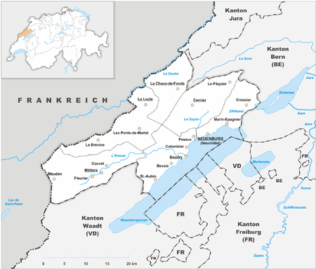
The Republic and Canton of Neuchâtel (French: République et Canton de Neuchâtel) is a French-speaking canton in western Switzerland. In 2007, its population was 169,782, of whom 39,654 (or 23.4%) were foreigners. The capital is Neuchâtel.
Excerpt from the Wikipedia article Canton of Neuchâtel (License: CC BY-SA 3.0, Authors, Images).Canton of Neuchâtel
170,
Geographical coordinates (GPS) Address Nearby Places Show on map
Geographical coordinates (GPS)
| Latitude | Longitude |
|---|---|
| N 46.983333333333 ° | E 6.7833333333333 ° |
Address
170
2318 (Rochefort)
Neuchâtel, Switzerland
Open on Google Maps


