Gedgrave
Civil parishes in SuffolkEast Suffolk (district)Suffolk CoastalSuffolk geography stubs

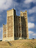
Gedgrave is a civil parish in the East Suffolk district, in the English county of Suffolk in eastern England. In 2005, its population was 30. Gedgrave once had a church called St Andrews. The village is part of a joint parish council with Orford. Gedgrave gives its name to the Gedgravian Stage of the Pliocene Epoch in British geological stratigraphy. The Sites of Special Scientific Interest Gedgrave Hall Pit and Richmond Farm Pit are situated close by.
Excerpt from the Wikipedia article Gedgrave (License: CC BY-SA 3.0, Authors, Images).Gedgrave
Gedgrave Road, East Suffolk
Geographical coordinates (GPS) Address Nearby Places Show on map
Geographical coordinates (GPS)
| Latitude | Longitude |
|---|---|
| N 52.084 ° | E 1.51 ° |
Address
Gedgrave Road
IP12 2BX East Suffolk
England, United Kingdom
Open on Google Maps


