place

Linwood Cemetery, Christchurch

Cemeteries in ChristchurchTourist attractions in ChristchurchUse British English from March 2013
Linwood Cemetery 25
Linwood Cemetery 25

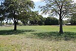
Linwood Cemetery is a cemetery located in Linwood, Christchurch, New Zealand. It is the fifth oldest public cemetery in the city. Despite its age, it is still open for ashes interment, Hebrew Congregational burials and if there is space in existing family plots. Opened in 1884, it has seen some 20,000 burials. The first burial, of the Sexton's wife, was held in July 1884 before the cemetery was opened. For some years, a tram line stopped within the cemetery before terminating on what is now Pages Road. The tram lines going into the cemetery are still visible under the tar-sealed road leading from the Butterfield Avenue car park. A tram hearse was built at some expense for the time by the Christchurch City Council but is believed to have never been used. The human remains from the Jewish Cemetery in Hereford Street were relocated to Linwood Cemetery after the Hebrew congregation sold the land of their earlier burial ground. A memorial to those re-interred was put in place but was badly damaged in the February 2011 earthquake. After the removal of the Sexton's house in the 1980s, the cemetery was subject to neglect and vandalism. The Friends of the Linwood Cemetery, a charitable trust, was formed to preserve and maintain the site and promote it as a valuable heritage site for the city. The Christchurch City Council produced a Conservation Plan for the cemetery in 2006. Linwood Cemetery is the resting place of a large number of notable residents. Those buried at Linwood Cemetery include 13 Christchurch mayors, several Members of Parliament, bishops and ministers, and the Peacock family whose philanthropy is associated with the iconic Peacock Fountain in the Botanic Gardens.

Excerpt from the Wikipedia article Linwood Cemetery, Christchurch (License: CC BY-SA 3.0, Authors, Images).

Linwood Cemetery, Christchurch
Butterfield Avenue, Christchurch Linwood

Geographical coordinates (GPS) Address Nearby Places
placeShow on map

Wikipedia: Linwood Cemetery, ChristchurchContinue reading on Wikipedia

Geographical coordinates (GPS)

Latitude Longitude
N -43.5299 ° E 172.6828 °
placeShow on map

Address

Butterfield Avenue 25
8061 Christchurch, Linwood
Canterbury, New Zealand
mapOpen on Google Maps

Linwood Cemetery 25
Linwood Cemetery 25
Share experience

Nearby Places

Ngā Hau e Whā National Marae, Christchurch

Ngā Hau e Whā National Marae is a large marae in the Christchurch suburb of Bromley. The marae opened in May 1990 and is administered by Te Rūnanga o Ngā Maata Waka, a local pan-tribal Urban Māori authority. The site was set aside by the Christchurch City Council for use as a marae in 1977. The location was part of Cuthbert's Green park. The planned marae triggered 180 complaints from nearby residents, but the marae project went ahead. The site is immediately adjacent to the Christchurch Wastewater Treatment Plant. Construction of the marae began in 1981. During the construction the project ran out of money, and ownership of the land was transferred to the New Zealand Government. One of the earliest installations at the marae was the carved entrance gateway, titled Te Amorangi, unveiled in late 1982. The carving depicts William Hobson and a Māori chief signing the Treaty of Waitangi, as a symbol of the coming-together of Pākehā and Māori. The lone chief is symbolic of the various Ngāi Tahu rangatira (chief) that signed the treaty on behalf of their iwi. The main wharenui of the marae is named Aoraki, in reference to the Māori creation myth of the South Island. It is the largest wharenui of its kind in New Zealand. The construction utilised local unemployed people as labourers, to give opportunities to the community. One of the wall carvings depicts explorer James Cook, to represent that Pākehā are also welcome. The marae was officially opened in 1990 during a ceremony by Minister of Māori Affairs Koro Wētere. In the aftermath of the 2010 Christchurch earthquake, the marae hosted 26 government agencies to make them accessible to the community. This included hosting a day-to-day criminal court, an initiative that was praised by the New Zealand Law Society. In 2018, a social housing facility opened on the grounds of the marae. The marae hosted a walk-in vaccination clinic during the COVID-19 pandemic. In 2021 a medical centre opened at the marae, providing low-cost access to general practitioners.

Dallington, New Zealand

Dallington is a suburb of Christchurch, New Zealand, on the north-east side of the city. It is bounded mainly by the Avon River, stretching in a circular area from the intersection of Gayhurst Road, Dallington Terrace and Locksley Avenue along to New Brighton Road, North Parade and Banks Avenue where it meets the intersection at the other end of Dallington Terrace and River Road. Its neighbouring suburbs are Burwood, Shirley, Richmond, and Avonside. It was originally named Dudley's Creek after a local farmer, John Dudley (1808–1861). Henry Jekyll (1844–1913) bought the farm about 1879, naming it Dallington after a Northamptonshire estate.On 4 September 2010, it was severely hit by a 7.1 magnitude earthquake, causing immense damage. Consequently, the St Paul's parish church and school which had suffered greatly from the effects of the quake, were forced to relocate their church services to the Marian College chapel and the students to the Catholic Cathedral College site, for the following couple of years estimated that it would take to rebuild. The college accommodated the entire primary school community of St Paul's School for a short time. But the February 2011 Christchurch earthquake (6.3 magnitude) caused far worse devastation to the city than the September 2010 earthquake. Large areas of Dallington were placed into a residential red zone, under which houses were acquired and demolished by the Crown. Parts of Catholic Cathedral College were under the unstable 400-ton dome of the Catholic Cathedral. Because the dome was in imminent danger of collapse, the college left the site and St Paul's School was moved to a site which the Minister of Education made available in Champion St.